


I’m a bit late coming to this discussion thread, and my comments will just relate to one point from your original post, in which you were commenting that “the current way to deal with neutral nations is not good and makes the playing feel simulated.” I quite agree that the game’s division of non-player countries into three types of neutrals (pro-Allied, pro-Axis and strict) and its two types of rules for neutrals (one for the pro-type neutrals and one for the strict neutrals) is problematic in several ways, particularly the rule which says that every strict neutral state in the world joins side X when one of these states is attacked by side Y. A point that should be kept in mind, however, is the reason why those rules exist. The reason for the existance of the rules makes a certain amount of historic sense, even though the actual mechanism of the rules is arguable
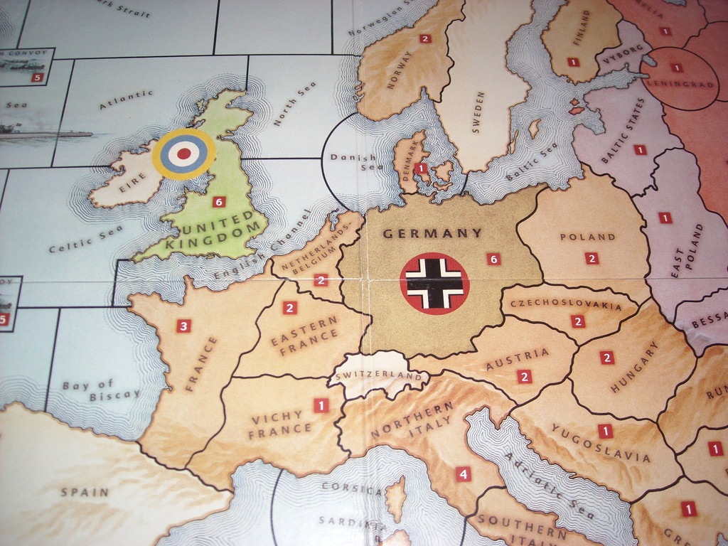
I don’t think the rules actually state the rationale explicitly, but it seems clear – based on an examination of which countries have which type of neutral status – that the neutrals rules are meant to strongly encourage (one notch below “force”) the players to replicate some of the historical events of WWII which occured after the game’s 1940 start date. These situations include certain countries fighting alongside the Axis powers as co-belligerents (examples: Finland and Iraq) and certain countries being pitched into the Allied side either because they were invaded by the Axis (examples: Yugoslavia and Greece) or because they were preemptively invaded by the Allies over concerns that their current government was too sympathetic to the Axis (example: Persia / Iran). As for the very unrealistic “every strict neutral state in the world joins side X when one of these states is attacked by side Y” rule, it’s basically a blunt instrument aimed at keeping all the player powers out of the states that managed to stay neutral in WWII. And to reinforce the message, the neutral states are given different-sized “keep out” signs (the size of their standing armies) to underline which ones the players are particularly discouraged from invading. Turkey, with its standing army of 8, comes at the top of the list – nor surprisingly, because Turkey offers a potential link-up between the war in North Africa and the war in Southern Europe and the USSR.

