


Another issue is that they are out of print–they remain popular in the Tournaments and so they are even re-building starters/boosters I believe (by re-bagging the correct rarities of the available loose pieces) because the sealed boxes ran out a few years ago.
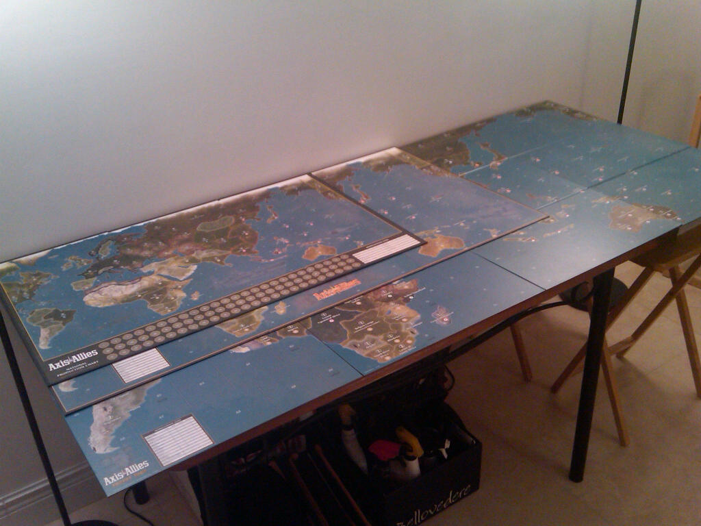
Picture of AA Maps compared
-
So I grabbed my AA42, AA50, and AAG40 maps and had them all start from the same point (top left hand corner).
Impressive, eh?
-
The map of 1942(excluding borders and income chart) are about the same size as 1 of the 4 global board pieces
-
Can you separate them so we can see the scale of different territories?
-
yeah, I got 2 copies of all these games. The 42 board sucks- very hard to fit the pieces on it- board is too smaller. AA50 is just right, but of course the 40 boards are epic!!! 8-)
-
Calvin, I tried doing that and ran out of space. Each map is drawn proportionally identical, if that helps.
-
Two notable differences are that, in the Global map, the Arctic region got chopped off and a vertical slice got cut out of the centre of North America. Losing the Arctic doesn’t bother me because it creates a bit more space to allow the rest of the map to be made bigger, but I find the North American deletion a bit irksome because it makes the contrast between the two sides of North America – which is already substantial because of the scale difference – look even stranger. But in the overall scheme of things this is just a minor annoyance because the overall map looks great. I put the Global map together last night for the first time and I found it pretty spectacular, both in terms of size and appearance.
-
Very nice.
-
I am so happy right now… :-D
-
Impressive
-
-
Has anyone else noticed that on their boards the shade of blue in the ocean is different on the section that includes South Africa? The other three boards are all the same shade. It’s not a big deal, but it does drive me a bit crazy. I have two set’s, and this is a problem on both of them.
-
Has anyone else noticed that on their boards the shade of blue in the ocean is different on the section that includes South Africa? The other three boards are all the same shade. It’s not a big deal, but it does drive me a bit crazy. I have two set’s, and this is a problem on both of them.
Yes, it’s that way on mine too. But if you scrutinize the water all over all the boards, there are a lot of different shades, and some of them appear intentional. What bugs me is how the US doesn’t line up with itself. Sometimes I like to set up the boards so that the US is all intact, so it’s easier to see the action there. The break between Europe and Pacific seems to be a good place to have on the edges, as an alternative. But the USA is nowhere near lining up on the side of the board. :x
I see there are only 2 seazones between West Africa and South America still…… Kinda weird, considering there are 5 zones between Sumatra and Africa, but whatever…
Suggested Topics

