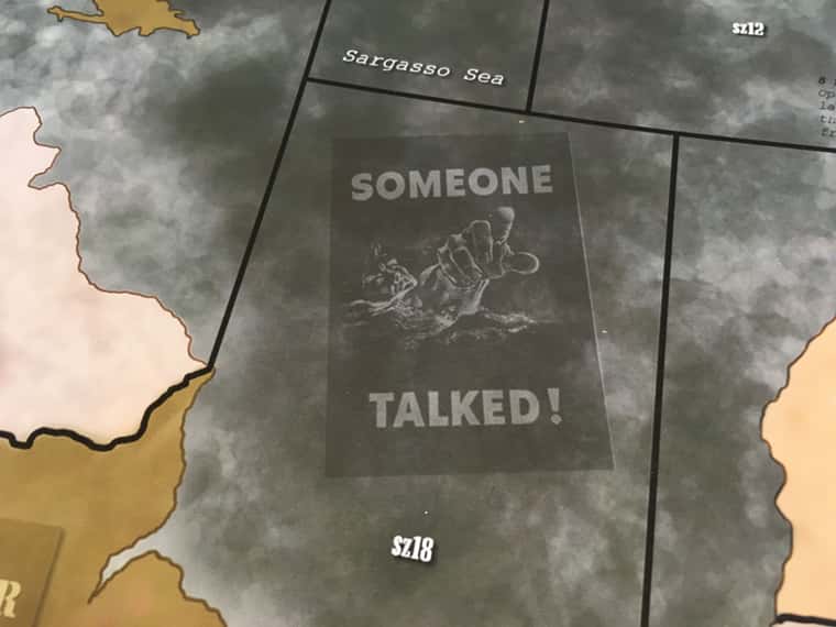
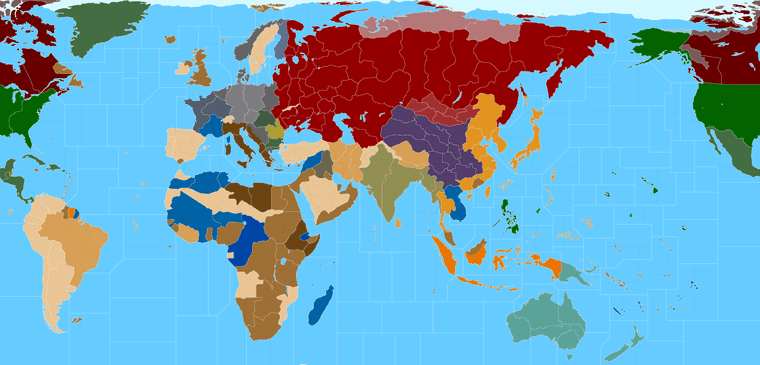
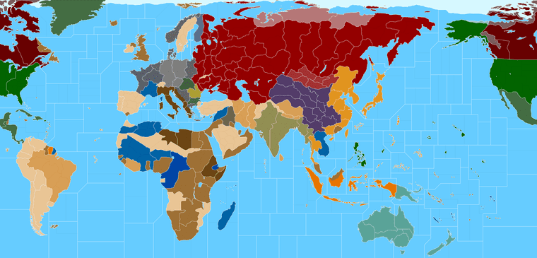
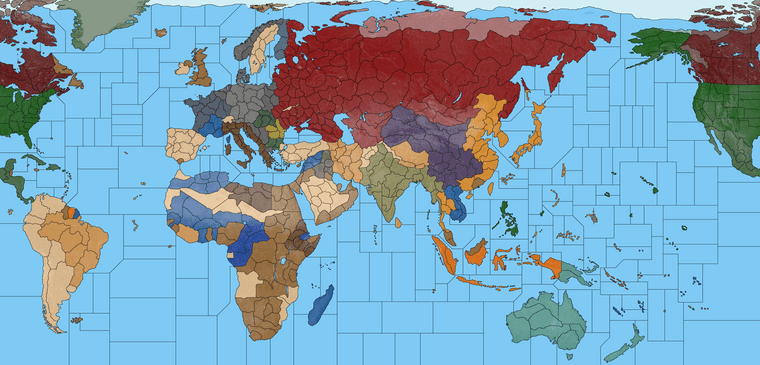
Working on a New Map 40/41: Seeking Suggestions

  • 2024 '22 '21 '19 '15 '14

    Hey what’s up gang! It’s been a while!

    I had a request to design an updated tripleA map for use at 16000 px, so I’m trying to pull off a projection that could also work for G40, or alternative timelines for games at that scale, using the more traditional territory tiles and boundaries.

    I’m about half way through the process, so you’ll have to forgive some of the oddballs here. I’m still working on defining the TTs, but I just wanted to gather some feedback if possible, and to find out what’s working (or not) on the quick read haha. It’s based on my earlier projection for V3, with an original warp on the world that I devised to suit my preferences.

    For a visual presentation, my thought was that for every Territory tile in Global, there would be say 2 or 3 or 4 regional subdivisions, depending on the significance of the spot. These would be decorative at the G40 scale, but the idea was that in TripleA at 16000 px we could also create a playable game with several more TTs. Basically the subdivisions would unlock, if the player elects to play an expanded sort of game at the largest scale, while still harmonizing with the OG divisions at the standard scale (probably 25 or 50% map view). Right now there are many more subdivisions included than I think would be necessary, but I was building off an earlier map I’d made, just to give an impression. Each subdivision tile should be able to house a dozen different sculpt icons before spill over occurs, which seems sufficient. Under the G40 divisions we should have no prob. A territory corresponding to the size of say Baltic states will fit 36 scultps at 54 px, when the map is at 16000px before the unit’s start spilling over into adjacent tiles, so feels pretty solid.

    I’m trying to work something that would allow for units at 54 px or ideally 72 px, rather than the current tripleA standard 48 px. For comparison, the current Global 1940 map in TripleA is at right around 12000 px wide, so this one would be about 25% larger in the same display. The goal is to get something that would work reasonably well for a 4K presentation.

    Here it is previewed at 25%

    TripleA_4k_baseline_G40_example_25.png

    Here it is at scale…

    https://www.dropbox.com/s/yp6ulpzggsvnphw/TripleA_4k_baseline_G40_example.png?dl=0

    The way tripleA utilities work, it requires a border line at 1 pixel, for whatever the max scale. So basically I’m redrawing everything at 16000 px, that way when it downscales the borders will still look clean in game. For the map reliefs we can doll up the borders to be wider (like 3 pixels instead of 1) but this is sorta of my working draft. It’s half way between the official cartoon, and a more realistic map I guess. I’m battling the uncanny valley a bit there, as the more realistic I make the contours the more the OOB distortions kinda show, so it’s a bit of a compromise between housing enough units and looking recognizable (at least in relative terms.) I was pretty happy though, so figured now was the time to invite the critiques, so I can refine it before getting too far along.

    Here is the expanded view showing all the mini-tiles. Still a WIP but gives some ideas. There are probably about twice as many as we’d need really, but just wanted to lay down some lines.

    TripleA_4k_baseline_G40_example_flags_25.png

    At scale with the beefier black borderline…

    https://www.dropbox.com/s/cfbiii4lb6ql261/TripleA_4k_baseline_G40_example_flags.png?dl=0

    If you got ideas, or secret dreams, hit me up and I’ll try to accommodate. Right now the theme is digital, but if I clean it up enough, I’d eventually like to make a print friendly version, since it’s relatively simple to upscale once the 1px border divisions are in place. The map could also be compressed or scaled at that point, since I’m designing the baseline as a vector svg. TripleA uses raster graphics for everything, but I wanted to make something more legacy that could be used by others down the line.

    This one is rather ‘mappy’ right now, as I haven’t yet added a Topo relief or anything like that. I was just trying to work something up with a webcolor blocking first. It looks 1941-ish in this display, since that was the requested start date for the larger game. The tints and shades on some of tiles/subdivisions are just for historical decor at this point, and to give it a bit more color, but I was digging the sweep. My thought was that it could crop at the Antarctic, or maybe use that area for inset boxes, or decorative type elements. Basically doing that stuff at the bottom of the board rather than the top, if desired.

    Some of the Global TT divisions still need to be noodled, and obviously I haven’t added any SZ tiles. But I figured I’d post it right quick, to see if there is anything major that I’m missing or if anyone has some thoughts on how to do the regional subdivisions in an interesting way.

    My main goal was just to find a general warp for the World Projection that worked, which I think I’ve just about settled on. There are definitely some challenges translating the Official board, particularly where the two theaters converge at the center. I tried to tamp down the distortion there when possible. Probably will recast the Eastern Front a bit to enlarge some tiles there, but it’s pretty close. Some of the smaller subdivisions showing here would be eliminated in the final or cartooned out to be large enough to house say a dozen units at the 16000 scale. The boundaries aren’t fixed so I’m sorta doing the stretch and pull as I go lol.

    Anyhow, just thought I’d say hi and kick it around for a few. Feel free to be brutal and take me to task, since critique is what I’m after at this point. It’s just a WIP right now hehe

    Hope you’ve all been well!
    Best

    Elk


  • @black_elk Looks Awesome !

  • 2024 2023 '22 '21

    That is truly great work - and a massive task you’re in to.

    Since you asked for input & inspiration from players, I’ve attached a few pictures from our own design of the A&A Revised Edition Game Board.

    A&A Revised 9.JPG A&A Revised 10.JPG A&A Revised 11.JPG A&A Revised 1.JPG

    Some territory names were also changed from the OOB version, such as Western Europe was changed to Western Front - and in the east some territories were named North Eastern Front, Central Eastern Front & South Eastern Front.

    I hope you’ll find some inspiration:+1:

  • 2024 '22 '21 '19 '15 '14

    @the-captain Badass!!! Revised has a special place in my heart for sure! I love the detailing there on the one you just posted! I’d love to do a few different reliefs for different styles at some point. One sorta Classic and ‘mappy’ looking, one more like the Topo reliefs from the more recent boards, maybe a darker one too in case people like the deeper blues for the Sea Zones.

    Here is the same map but with the oceans done in Navy Blue, in case anyone likes the more Revised style callback… I isolated and removed all the divisions except for the ones displayed in Global 1940, shown as 1px black line.

    At scale it’s 16000px but here it at 25% view, for readability on these forums. I paint bucketed that Arctic ice sheet to be blue there, just for the cleaner read in the 3 color, or if one wanted to use that space in other ways. I kept the dividing line, just painted slightly differently than the earlier posts, cause the ice sheet thing only really looks good once the map is painted out in fuller colors haha.

    TripleA_4k_baseline_G40_example_navy_25.png

    This bitmap I’ve been working up is at a 16:9 aspect, but I tried to make it in such a way that one could slide the continents a bit if one wanted to make larger oceans say. I was trying to iron out the kinks as a raster, but then the thought was to get a pull in inkscape and save it out as an svg so it would be easy to upscale/downscale or warp as desired from a vector rather than a raster image.

    Here it is as an svg of the simple baseline, in case you like to play around with it in inkscape or illustrator. In those programs it’s much easier to score the lines at the desired width, or warp and manipulate the map for uses outside tripleA. Like if one wanted to print it for an actual gametable, probably would want to crop the Antarctic, then extend the warp more vertically, or stuff of that sort, which is a bit easier to do in vector. It doesn’t have any sz included yet, cause I figured people might like different designs. Or if they wanted to use the same world projection but do AA50 borders rather than Global borders, or original borders of their own devising heheh.

    https://www.dropbox.com/s/ehcnfkr28llq8gg/TripleA_4k_G40_vector.svg?dl=0

    If you’d like to make use of it in any of your customization projects, feel free! I made it for us, and for the future! heheh

    Here is the development thread at tripleA, in case anyone likes to see the design process thus far, or check out the conversations which brought us to this point. I’ve been posting almost daily revisions, trying to work in feedback from the gang.

    https://forums.triplea-game.org/topic/3315/proposed-map-domination-1941

    All the best
    Elk

    ps. here’s where I’m at right now…

    https://www.dropbox.com/s/fbpnc3q4ccjrgqr/TripleA_4k_baseline_G40_subdivisions.png?dl=0

    For a visual/aesthetic preference, I prefer the land TT colors to be more mid-tone in values and the sz lighter, or else land lighter in value and sz more mid-tone. Basically just to get some contrast going between land and sea. In tripleA one can play with the HEX in map properties to change the colors, but just sort my hard and fast for sz. Something like this…

    TripleA_4k_baseline_G40_subdivisions_25.png

    Or something like this…

    TripleA_4k_baseline_G40_subdivisions_navy_25.png

    More or less. Just for the quick read, depending on whether one likes darker or lighter oceans, ie more Classic style vs more Revised style I guess heheh. I pushed the grays there to be a little more extreme than 50% either direction just to show, although usually I’d say land at 50% gray in value is what people tend like for the player nations (around that value range just with the saturation/hue tweaked depending on the player nation’s color). It really works best if Axis are at say 60% color value and Allies are 40%, or just that there’s enough value variation there so when they pair off adjacent it looks cleaner on the quick read. That’s more for like standard default colors in tripleA (which can be changed in map props) but for the sz color value I think one needs to do that in the baseline/relief. At least for the basic values I mean, since you can change that with reliefs to some extent by messing with the opacity/saturation in layers, but I like the idea that if all map details were turned off that it would still look good.

    I if think if we go dark sz, then having brighter ships is good for the units, or vice versa for the ground units. Just depending on how dark or light one goes with the color values for either.

    Ideally the player would be able to choose from some kind of display setting for some of that stuff, but I think the way it works in tripleA, we need two different reliefs or map skins to pull it off.

    I’d probably do the same for White borders vs Black borders style, cause I think that’s another thing people might enjoy having control over. Couple different decorative motifs would also be rad. Basically so you could trick out your digital board to look more like your fav physical boards. That’d be the goal, cause that just seems cool as all get up to me! haha

    Basically so you could select a prefered style for SZ color and border boundaries, and then get a choice for more Topographic relief or more Decorative/Political relief, as like as a mapskin choice. That would be pretty clutch


  • @black_elk

    I like your dedication and your work.

    This weekend we have an Axis & Allies Globale 1940 event - veterans only - all games are played with the complete Axis & Allies Global 1940 House Rules Expansion.

    From 8th to 11th December we have arranged the 2nd Axis & Allies Northern Europe Wiking-Con, where players travel to Denmark from Holland and Germany.

    During both events, I’ll shortly discuss your G40/41 map with the players - and bring you feedback asap.

    Since all our players (at this point we have advanced to 88 registered players who all use or are familiar with the Axis & Allies Global 1940 House Rules Expansion) play the Table Top /Game Board version FTF - and most also play online - I’m convinced that we’ll receive useable feedback.


  • @the-captain said in Working on a New Map G40/41: Seeking Suggestions:

    we have advanced to 88 registered players

    Awesome !!! :joy: :joy: :joy:

  • 2024 '22 '21 '19 '15 '14

    Sounds rad! Just tried to work up some sea zones and clean up a few tiles. I think it’s coming along now.

    Here it is with some quickie naval units for the vibe…

    The hope is to get something looking good with Frostion’s units since they’re a bit larger

    triplea_4k_baseline_g40_subdivisions_sz_ships_100.png

    Ships there are around 72 px.

    With some extra fighter aircraft I threw together showing tech tech advances for LR and such. Just to get a sense for how it would fill out there with a bunch of units at once.

    Ideally the units could be upscaled a bit, but my goal is to avoid a bunch of clipping and to have stuff fit nice and comfy.

    Here’s the larger map with some more of the Atlantic added in, and the tiles in Central and Eastern Europe cleaned up a bit…

    TripleA_4k_baseline_G40_subdivisions_sz_25.png

    Here’s the big bitmap showing the same at 100%, before I hit the hay lol

    https://www.dropbox.com/s/6wdj4i1rcka8y99/TripleA_4k_baseline_G40_subdivisions_sz.png?dl=0

    Anyhow, that’s where we’re at right now. Will crack into it some more tomorrow. Catch ya in a few!

    Best Elk

  • 2024 '22 '21 '19 '15 '14

  • 2024 2023 '22 '21

    Looks great - lot of work to be done.

    It might be an idea to have the sea zones more or less the same as in OOB G40 - at least concerning the distance between Key Islands and Key Territories.

    Example:
    The distance (number of sea zones/territories) from Tokoy (Japan) to Philippines is 3 spaces when you move by sea.

    Depending on the Length of Time the game should last (minimum/maximum) - and which Winning Conditions must be achieved - the number of spaces (territories & sea zones) should reflect these aspects.

    The Eastern Front might contain up to 7 territories from north to south - three lines in depth.

    Example:

    • 1st line: Baltic States, Eastern Poland, Bessarabia.
      This line should be split up into 6 territories.

    • 2nd line northen part: Novgorod, Belarus

    • 2nd line southern part: Western Ukraine, Ukraine
      This line should consist of three territories north of Pripet Marshes - and three territories south of Pripet Marshes.

    The territories north and south of Pripet Marshes are not adjacent. In other words - Pripet Marshes separate the three northen territories from the three southern territories.

    • 3rd line: Archangel, Smolensk, Bryansk, Rostov
      This line should contain 7 territories.

    Example:
    A German offensive on the Eastern Front depends on the number and strength of German Army Groups.
    Army Group North, Army Group Center and Army Group South would be needed - in order to achieve either a Breakthrough - or to create Strongholds in order to counter a Soviet Large Scale Offensive.

    Why:
    The Eastern Front was by far the longest frontline of World War II.
    Massive Army Groups attacked & defended vast areas on a broad frontline - often thinly manned, due to the vast distances.

  • 2024 '22 '21 '19 '15 '14

    @the-captain Thanks!

    I’ll get back in the kitchen on it tomorrow to make sure the connections are all correct haha. I think my eyes were starting to blur over towards the end there, as I nearly entered the matrix and all the sea zones started looking like skynet circuits heheh

    Great ideas!

    I got Barney making the list for stuff to fix up for the next pass. All the tricks and treats lol. Keep em coming!

    Catch ya next round!

    ps. Tried to work the lines, but I might have missed a few. Will take another pass over the weekend.

    Still needs some clean up in a few spots. Was thinking for the sea zones to have those subdivision bisecting islands when possible to make them more interesting. So for say for the costal sz off Morocco maybe get broken into 2 or 3 tiles so it can hit across Canaries or Azores. Have Bermuda riding a line and Malta, stuff like that. Basically the smaller tiles in either ocean can fit about 18-24 units at 54px, so that could be the scale I think. Playing the regular global game those units could probably upscale a bit more.


  • @black_elk Would bust SZ 6 into a Sea of Japan/East Sea sea zone & a “pacific west of japan” sea zone

  • 2024 '22 '21 '19 '15 '14

    TripleA_4k_Domination_1941_painted_med_channel_25.png

    Just did laid down lines where I thought they might be interest. In general the idea was to create some interesting around the islands and to give more places for ships to go, line if including sz cash in the form of convoys for transit lanes and such. The smallest sz tiles here can fit about 18-24 units with the digital sculpts at 54 px, so just to give a sense. I got about half way around the board, before trying to decide whether to split Celebs on the vertical or the horizontal, so I thought I’d pause and take stock heheh

    https://www.dropbox.com/s/tugjcvsb5y106rl/TripleA_4k_Domination_1941_painted_more_sz.png?dl=0

    fe91fcca-df7c-4096-8e57-5692ac83282f-image.png

    Celebs_Pacific_detail.png

  • 2024 '22 '21 '19 '15 '14

    Here it is with white borders…

    TripleA_4k_Domination_1941_painted_med_channel_white_light_25.png

    Here it is with oceans in darker blue, with the white border lines. In case people prefer a more revised style presentation for the ocean/sz color

    TripleA_4k_Domination_1941_painted_med_channel_white_25.png

    The perception of any given color will change quite a bit, just based on the value/vibrancy of colors surrounding it, which going from light blue oceans to dark blue oceans highlights pretty clearly. I only changed one color in isolation there, between those two images, but of course doing that, our perception of everything changes in relation haha. So one might prefer a few different shades/HEX colors for the various player-nations, depending on whether they like a lighter read or a darker read, overall, for their map aesthetic. But just to give an example

    Best Elk

  • 2024 '22 '21 '19 '15 '14

    Here’s an idea for how to do Germany…

    So the dark strip TT there maybe allows aircraft to pass over, or for ships to be produced into the adjacent sz, but prevents amphibious landings directly into Saxony and such?

    G_detail.png

    Or not heheh
    This is probably simpler…

    TripleA_4k_Domination_1941_draft_25.png

    Here it is at 16000px

    https://www.dropbox.com/s/qc3xgrbtqp55gt6/TripleA_4k_Domination_1941_draft_1px_borders.png?dl=0

    Some example German digi-sculpts using the Frostion units.

    German_units.png German Units Scaled.png

    That detail shows the digital sculpts at at various scales. So like Saxony is displaying units at 100%, Berlin at 110%, Belgium 75% etc. Just to give a sense for the possible playscales.

    I like 75%-87.5% for the units/centers with a map at this size and all super divided up lol. 110% or larger would be better for Global.


  • @black_elk With that many sea zones and land areas, the game will take weeks. People don’t have that kind of time to play such a game. Its just too much to worry about, so replayability is doubtful in my estimation. Also, Greenland looks dreadful as if Godzilla was trying to pull it apart like play-doh. I would concentrate on making player options the key offering that exceed global 40 with new strategies that can lead to victory, not another map with hundreds of new sea zones and land areas. IMO

  • 2024 '22 '21 '19 '15 '14

    @imperious-leader

    Thanks for the feedback. I think you’re mixing up the digital draft templet with what it’s intended to turn into lol.

    The idea was to provide a bunch of lines that could be erased for that.

    I mean did you see the G40 one?

    TripleA_4k_G40_painted_25.png

    The crazy TT SZ subdivisions of the other baseline draft obviously would not work for a physical A&A game, or for anything outside of tripleA really. It’s meant to be broken down with smaller tiles collapsing into larger tiles. Or with those smaller divisions being retained purely as design elements. In tripleA the player/designer may wish to create a scenario that is more like a total war game or intended for a single player vs an AI and stuff like that, but that’s more for digital games where the unit sculpts can be scaled and the map view changed dynamically. For a physical mapboard you’d need to prioritize a more normal playscale with normal sized sculpts and normal TT sizes to house them. But even there, if one wanted to say split a particular TT or SZ in half or change it’s shape, that there would be some lines and contours in place to serve as guides for that. So the map creator could choose what to include and (more importantly) what to omit haha.

    Here is a quickie visual to help clarify the gist of what’s going on…

    detail.png

    The white lines there show an example of some actual TT divisions, like for an actual game at a G40 scale. The black lines simply provide guides for how those territories could be drawn, or further subdivided, if one wanted to say add another tile in France or on the Eastern Front or wherever, or include another sz or convoy zone somewhere, to recast the shapes and make a given spot larger, or simply for flavor to provide some visual design interest when creating reliefs from them hehe.

    You know like where the black lines would be knocked back or made less opaque as a transparency, or removed entirely where extraneous, stuff of that sort.

    Part of the reason I approached it in the way that I did, was to give a templet that could service different timelines or start dates as well as different playscales, which might recommend different TTs or differently shaped TTs, so it could be more adaptive in that way.

    But the actual look of the thing, when all is said and done, may look less like that, and much more like this… Just cleaned up, and at 16000px, for a G40 scale - rather than AA50 at 3700px, which is what you’re seeing below.
    :)

    tripleA.png

    ps. Thanks for the Greenland Godzilla dig too! lol
    I’m sure I’ll get around to fixing it eventually hehe

    Happy Halloween!!!
    ;)

  • 2024 '22 '21 '19 '15 '14

    Ok I gave Greenland another quick pass lol. It could probably be cleaned up more, but this is a draft blocking.

    TripleA_4k_working_25.png

    https://www.dropbox.com/s/7fwyake8wqyunco/TripleA_4k_working.png?dl=0

    The basic idea here is to build into a standard gamemap a certain degree of HR flexibility, beyond what we typically get, but for HR stuff that is more map oriented. You know making it somewhat easier for the player to adapt the map along different lines. Like for different start dates, or to add convoys, split a TT, make a spot impassible, or things of that sort. To make that sort of thing a bit more convenient to execute, without needing sharpies, or dry erase markers and laminate, or a background in design lol.

    The extra visual information is sort of just that, extra. Or at least for the normal A&A playscale. So it’s not like trying to make a new game that takes a month finish here, but rather to just give the player some options to build on, especially for the computer play. Whether they choose to utilize them, or how exactly, I don’t quite know, or at least not yet, which is why I posted it in this section.

    I just liked the way it carried as a visual design, because having some smaller regional tiles displayed in a subdued way seemed to reinforce what’s going on with the larger tiles, and I thought it looked cool hehe. But the germ of the idea was that it would be cool to have a mapboard that could do double duty in some fashion. I’ve been building thus far with tripleA in mind, because the concept is somewhat more versatile there and fills a certain niche, but I thought it might have promise for a physical game as well. Clearly it’s a WIP, but I wanted to share in case anyone has some ideas.

    Here’s a more ‘Revised’ looking one, with the super dark oceans… lol

    TripleA_4k_working_dark_blue_25.png

    I like to switch the SZ colors like that between the two extremes while working, to hunt down rogue floating pixels that got left behind while I tooling around with the pencil. For the subdivisions the thought would be to reduce the opacity there, so that they’re still visible, but more backgrounded. It’s just easier for me to work with Black and White in the draft, and also because that’s how tripleA parses the bitmap before loading the reliefs, which is why the look is more basic here.

    I cropped the Antarctic, and slightly widened the Atlantic and Pacific oceans so the aspect ratio would be closer to 2:1. I think that should give better room for the G40 division which could be slightly reshaped now, so that would be my next step. Like up in the North Atlantic around Greenland, since I won’t be able stop thinking about that forever now lol.

    The arctic ice sheet is just sorta an expedient for my quick paint bucket, but an idea for tripleA would be to draw it such a way that certain sz tiles get painted over in ice every other round say. Like so you can only get to Murmansk when the weather permits or stuff of that sort. Again, rough blocking, I think it could certainly be cleaned up hehe, but that was sort of the idea behind extending those sz tiles at the top of the board.

    Of course we still get that dead space in the southwest Atlantic and southeast Pacific, but I guess that’s where you’d stick a compass rose or key or whatever right hehe.

    For reliefs, I’d like to try one that is more topographical and one more political/balance of power painted colors, that could be changed on the fly.

    Or in the physical analog to have the Front side of the board show one type of relief and the Reverse side of the board show another. So one could have a display that’s more modern terrain style, and another that’s more classic mappy. Just seemed like that would be trick. For the digital game you do more than 2 options there, with map relief skins loaded up to service different styles or gameplay ideas.

    In tripleA if you turn off all the map reliefs/details, you get something more barebones in the look, sorta like this. But I’d like to still look at least halfway decent that way, for the ultra stripped down skeleton hehe.

    So far I’ve been just kinda winging it with the sea zone subdivisions, but an idea I thought might be cool was to divide each SZ tile in half, or at most 4 quadrants maybe. Say Alpha Beta Gamma Delta, just cause that sounds cool and reminds me of Star Trek lol, like for a tripleA game that’s all super zoomed in that way. But perhaps it could be used to explore a different kind of naval game on the actual board too? Like if you could use the same larger G40 tile, but maybe put a chip or roundel to indicate the exact Quadrant for different stuff. Maybe a convoy system more like the older Europe and Pacific games added back into it somehow, or some new thing with subs, or some kind of staged carrier battle. I don’t really know honestly, still kinda hazy there, but it seemed like it might be worth exploring. So that’s sorta where I’m at with it.

    Here it is with some more of the micromachines at various scales…

    The idea is to have the national painted units that Frostion created which are larger at 54px than the standard units at 48px - But then also a colorized tint version of the same.

    Basically so the player can choose their own colors for Units the same way they can for the map ownership colors, by just selecting a HEX color code in the map.properties. This would be cool I think for people who have different aesthetics preferences or also for the colorblind, where you could assign the color values based what’s easier to see, or just more pleasing to the eye. Which tends to very person to person.

    colorized.png
    example-units-scale.png japan.png
    ussr units.png
    Brits.png

    I’ll post again in a week or two when it’s further along.
    Catch ya next round!

    a00f2cd6-a44c-4584-a56b-d25fecf88d2b-image.png

    ps. here it is with some more corrections and enlarged G40 sea zones. I changed the geometry where I thought I could away with it, to prioritize the coastal sz tiles over the transit sz tiles. Hopefully should work a bit better for housing the ships.

    TripleA_4k_working_sea_zones_25.png

  • 2024 '22 '21 '19 '15 '14

    Started in on the terrain map. This is a quickie G40 blocking showing like halfway there. I was able to get pretty close just cause of remembering how I drew the baseline when back when lol. At this step it’s mainly about tweaking the terrain/borders shifting the flow of some rivers and mountains, knocking stuff back and painting it out, just so that the lines will all play nicely together given the general distortions of the globe we got going. This would be like the underlayer or relief skin before we clean it up and add in the fancy colored borders and such.

    terrain draft 25 percent.png

    ps. Almost there lol
    here is a preview indexed, just gotta bang out those last couple islands and clean house a bit. Shouldn’t be too much longer

    Terrain World_indexed-25.png


  • 2024 '22 '21 '19 '15 '14

    OK here’s a quick draft relief in case anyone wants to tool around with it…

    RGB

    Terrain World_20.png

    https://www.dropbox.com/s/hv8l6j6cntfncxp/Terrain World.png?dl=0

    Indexed

    terrain world indexed_25.png

    https://www.dropbox.com/s/gvotomlf59xg9ko/terrain world indexed.png?dl=0

    Base

    G40_base_25.png

    https://www.dropbox.com/s/27efkxfqbil6od0/G40_base.png?dl=0

    See ya on the next one!
    All the best

    Elk

    ps. I guess much of this thread is more Customization oriented now than HRs. If a mod wants to move it to that section that’d be cool. Or here I’ll just make a quick topic for the G40 stuff there, so my other ideas don’t overshadow that stuff too much lol.

    I’ll probably paint the terrain up a little a bit more and just update the dropbox as I go so as not to spam the boards too hard. Basically just needs some colored borders though, and I think it could probably get a dry run lol.
    :)

    domination_quickie_color_25.png

    domination_white_lines_25.png

Suggested Topics

  • 9
  • 3
  • 6
  • 11
  • 9
  • 6
  • 16
  • 8
Axis & Allies Boardgaming Custom Painted Miniatures

25

Online

17.0k

Users

39.3k

Topics

1.7m

Posts