


@GGleize ok but adding 12 ipc to allies especially Russia isn’t the same as just moving a German bomber. Germans can use a bomber admittedly, but a Russian bomber is alot more needed than saving the German bomber imo. Minimally, you need to move both German UKR planes away .
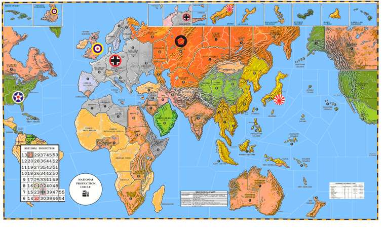
1942 3rd edition map thoughts
-
Just on the off chance we ever get another 1942 board, I’ve been thinking again about different approaches to how to draw the territories in Eurasia, particularly the eastern half of the continent. The last couple boards added a lot of tiles here as a way to deal with drives towards the center from the Japanese. So the Soviet far east and China get more carved up, lower ipc values etc. I think an alternative approach might be more interesting, with larger single territory tiles at a higher value and a production profile, that can allow for stacking there vs Japan, same way it works on the other side of the board with W. Russia or France or India.
Basically taking the whole eastern half of the USSR, Bury, Yakut, Soviet Far East and turning them into a single tile that functions the way Karelia did in Classic, with the deadzone tile between that and Japan being Manchuria. You could do the same thing with the Russian territories along the border with China collapsing them into larger tiles at a higher value, and then use Western China as the deadzone between that and the Japanese along Coastal China. The idea is to ditch the stall where the Eastern USSR just gets picked apart in low value border territories far from their production, and instead giving them a production capability there with ipcs to defend. Just using the familiar stack dynamic instead of special political rules or things of that sort to prevent Japan from steam rolling. I think it would feel more realistic, with the US deciding whether to send fighters to help cover the Soviet Far East and keep the stack there going, the same way W. Russia works on the other side. But essentially the concept is to create a north pacific pocket for Russia, the way we have a north Atlantic one, where the player is strongly encouraged to remain rather than withdraw. Victory on the Pacific side for Japan, if they went for that kind of Russian attack plan (over India) would be taking out that north pacific pocket. Giving that region of the board its own critical thing going on, instead of just serving as a speed bump on the road to the hammer and anvil at Moscoe.
What do you think?
I feel like USSR’s play would just look more WW2 that way, instead of being the weak link. Giving them more reach for the clap back, with enough production in the east so it doesn’t just fold. The basic map geometry and production values I’m picturing would be closer to classic, if Yakut/Soviet Far East/Evenki was a single factory tile. I think you could do a lot woth the warp of the overall world map, so that the expanded Soviet Far East tile takes up less real estate in favor of the central/south pacific. Going wide instead of tall for that half of the USSR on the game board.
Looking at the earliest map conceptions, as if the southern and eastern portions of the USSR played more the way Caucasus/Karelia do. e.g. having Kazakh and Novos as a single production spot, Evenki, Yakut and Soviet Far East as another single production spot. So taken together with Karelia and Caucasus you’d have 4 high value regional production tiles surrounding the core at Moscow, which can cover the entire Soviet landmass at a go, instead of all carved up and broken down.
-
I like DK’s hybrid map.
-
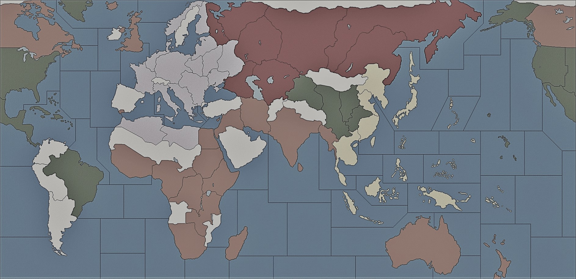
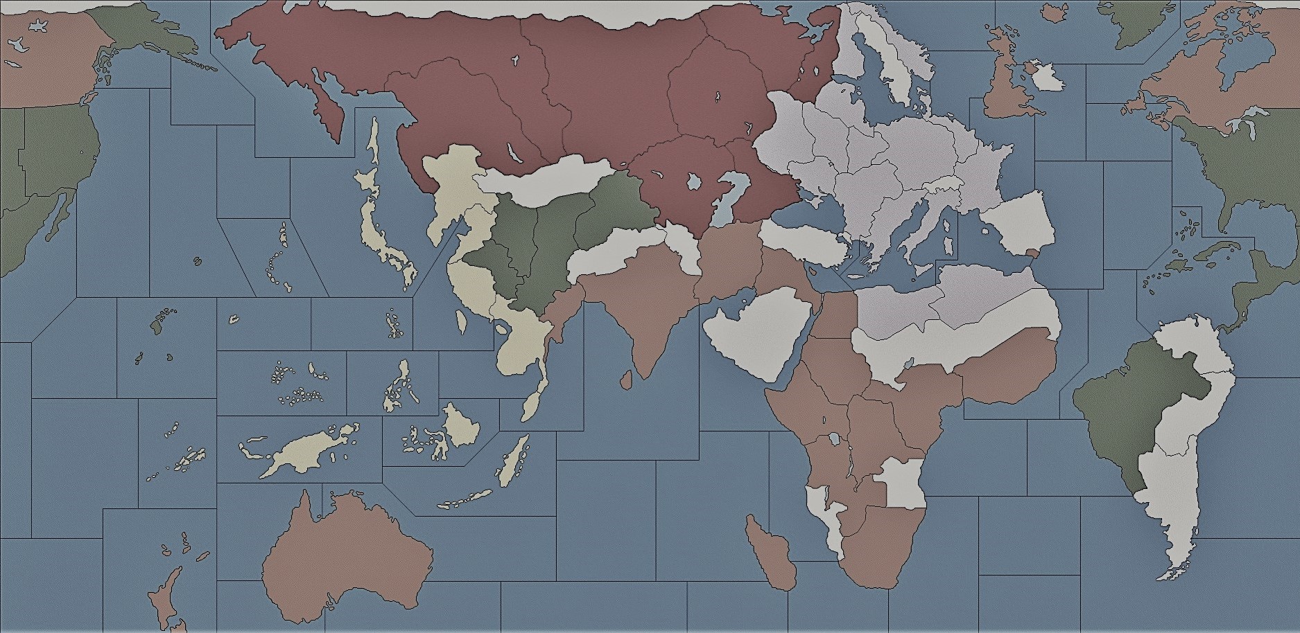
There are a lot of things I like about DKs map, especially for a game at the level above AA50. But that scenario includes 7 player nations + neutrals and a Soviet Union at like 20 tiles. What I had in mind was more like the classic 5 man set up. In the nova board above the USSR was imagined with 9 starting tiles for a total value of 21. The 1942.2 board has the USSR with 11 starting tiles and a value of 24.
I was thinking something more like just 8 starting tiles, but with a higher total value (maybe 30ish) where that value is concentrated in fewer overall territories. The Soviet Far East in particular I was picturing as a much larger and more significant tile, with a production profile so that it can be reinforced, and a starting unit distribution that has Japan and Russia more or less deadlocked over the Manchuria/Soviet Far East front in early rounds.
Instead of what we’ve seen in previous iterations where its too hard to cover the Soviet Far East against a Japanese amphibious coastal assault (so it just gets abandoned), you could instead get a slow build/stack vs stack along that border, with a simpler map geometry that allows units to shift from the Pacific to the center, the same way it works on the eastern front vs Germany. Fewer tiles and more reach basically.
The dynamic would be an extended Russian center pocket so that the Soviets have a way to get back onto the Pacific side in one or two turns instead of like 3-4 turns, and then have the counter weight stacking vs Japan be along the Manchuria front instead of pulling all the way back to Moscow.
Or I suppose if people are really wedded to the idea of a Soviet Far East deadzone, you could have the main eastern production hub be a larger central tile like combining Vologda, Evenki, Yakut into a single territory. But something on that side of the map that anchors the Russians and gives them a way to function in the far east so they can hold against Japan instead of just retreating. No need for a NAP or anything that complicated, but just trying to stabilize the movement along that front with the production/unit distribution so it’s more gridlocked against Japan. The same decreased distance would also allow for more interesting KJF positions, or favor endgame redirects where the Allies can shift fronts more easily from the Center Pacific to Center Europe or vice versa.
It would be an inversion of the trend from the last three 1942 boards, where Russia got more eastern tiles and fewer units to cover them, to a situation with fewer eastern tiles and more units to cover them basically.
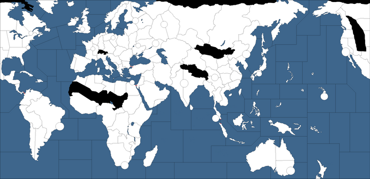
ps. Maybe something more like this?.. just rough hacking up one my old tripleA draft thumbnails in paint real quick, little choppy here but you can sort of see what I’m driving at. Kind of turning the geometry of East Asia around, so that the split in the Soviet Pacific and in China is simpler to reinforce and not such an easy steam roll Japan. Depending on how flexible you get for the ipc totals, you could basically give the Russians their Pacific production hub in either the Soviet Far East tile that encompasses like Yakut to Murmansk, or you could still it in the large tile that encompasses everything between the Urals and Siberia. Either way the Russians could redirect a lot more easily.
I think the same thing for China, where you could still have just the 4 starting tiles of 1942.2 but set up the geometry so its more defensible in tiers, instead of just allowing for a quick punch from the coast to the soviet center.
Perhaps the blocking here is a little too large for some tastes. I actually think you could also create a similarly stable warfront with a lot more tile divisions, but that would require one of the current eastern tiles like Yakut to be worth a lot more, with a larger overall economy, if Russia is meant to be trading constantly for a bunch of low value spaces. But this seemed like it might be simpler. Just with larger high value tiles that really don’t trade hands until someone is going for the win.
-
pps. anyone ever try the flip trick just to mess with the brain? hehe
sometimes it helps me to think about the connections in a different way, like a sinister alternate dimension where the map is sporting a goatee

-
@Black_Elk
Dude! At first I thought you heavily added the map before I noticed it is just a horizontal flip… -
Love the idea of combining yakutsk, evenki, and novosibirsk into one high value inland territory, with Soviet far east as the low value, coastal dead zone between Russia and japan.
-
-
You left out the center of Austrailia which is definatly one of thoese areas
-
I like those ideas for a more advanced board. I think you could get some fun production values and choke points using something like that.
Here’s a baseline with a bunch of tiles if anyone wants to play around. You can erase borders or redraw the geometry. I had the ocean pretty light from a while back, and don’t have any sea zones drawn on this one, but those are easy to add. The islands are probably overkill for a smaller board, but they’re simple to delete or round out into larger groups. There is a little clipping at the top with Norway since it was an older draft, but still pretty easy to carve up or extend if anyone likes to play around with ideas. This was off the AA50 projection I did, but it warps pretty well if people like to re-scale it. I tried to put in a lot of smaller political boundaries so that they could stretch relative to each other, before knocking em out to form larger divisions. Europe is pretty large here relative to the rest of the globe (I had it pulling off at Gibraltar in this draft for a larger med) but I think you might be able to stretch even larger there if desired just by tweaking the aspect, and still feel pretty recognizable. To get AA50 I just compressed Spain and expanded UK a bit. Usually some liberties are taken when drafting the eastern front or central Russia to match the A&A distortions, but tried to have Asia/China a bit easier to work with and Europe/Med scaled up as much as possible without smashing Africa too much. Scandinavia can also be compressed or tilted even more than I did here and I think it still works if people like a taller Europe or need more room for sz, but this was kinda where I settled for something similar to a classic projection but with less blobbing and some recognizable 20th century political boundaries to draw from.
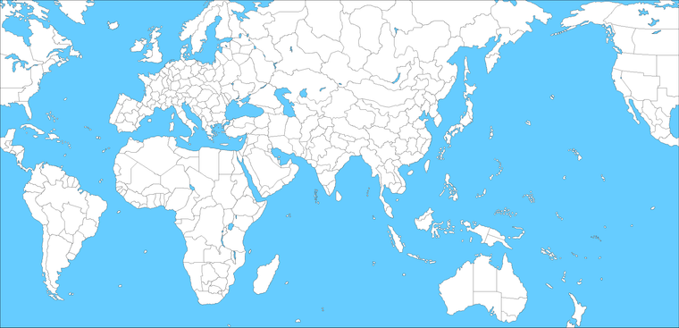

here’s a darker one more like revised if you like something deeper for the briny blue.

-
ps. That one was keyed off a scenario more late colonial era/early 1900s for Europe, but found it pretty easy to adjust for different eras once I knew where those spots were relative to each. Usually just needs a couple tweaks to make it recognizably 1940s after collapsing stuff down into larger regional tiles.
I think its easier to key in all the sz tiles first before adjusting the ocean color for tripleA use, but its pretty easy to switch after you have the divisions in place. Here the Atlantic ocean is compressed quite a bit since you didn’t need a ton of space there for AA50 scale, but is also pretty simple to extend, or move the wrap line if you need to add in more sz space.
That last one is about as dark as I can go before I can’t see the black pixels anymore, but you can make sz boundaries white after with a mapskin which seems to work pretty well for a more revised style look.
The A&A world map is pretty crazy, but I was fairly happy with how that projection turned out. I try to keep this one in mind when thinking overmuch on the relative scale, but I feel you can get away with a lot and have a world map that looks pretty familiar while still being playable for stuff like unit crowding…
-
@Black_Elk
whoa it’s a heartbeat :) -
@Imperious-Leader If you’re referring to my early draft of a 3rd-edition map, and saying that the center of Australia should be blacked out to indicate that it’s impassible, then my answer is that I’m only blacking out areas that would block at least one possible kind of movement. With only four tiles on the Australian continent, blacking out the center wouldn’t prevent any moves – unless you think Western Australia and New South Wales should not be adjacent by land?
-
You need to add another area to create a circle of areas, so you cant jump from the top half to Whales via Western Aus
-
What happened the idea that islands should not be surrounded by only one sea zone?
-
I don’t understand – my Middleweight map has multiple sea zones connecting to each of its islands.
-
I was referring to @Black_Elk 's project.
Suggested Topics

