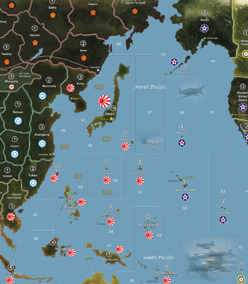
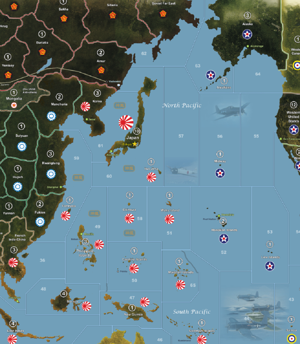
DK's Hybrid Axis and Allies Map and Rules


  • @Baron:

    With all these games on your map, did you see some weakness or bias which encite some play patterns over others. Does Atlantic is too small compared to Pacific, or PTO too large compared to ATO? Enough Convoys zones? Etc.

    I haven’t heard any complaints. I think the Axis have more of a struggle - but that can be balanced more with the setup. If I made a new map I would make the Pacific bigger and make it harder for Japan to get to Moscow, but we have fun with it as it is, so I doubt it would be worth all the extra effort.

  • '17 '16

    Hi DK,
    I never ever believed there would be any complaint on such awesome map.

    It required that you pointed out the Siberian Japanese Tank Drive to Moscow issue for me to inquire into these details and find out geographic discrepancies, which are not very relevant to the game anyway.
    Even Vologda TT is not an issue in itself. It is just about being more accurate.

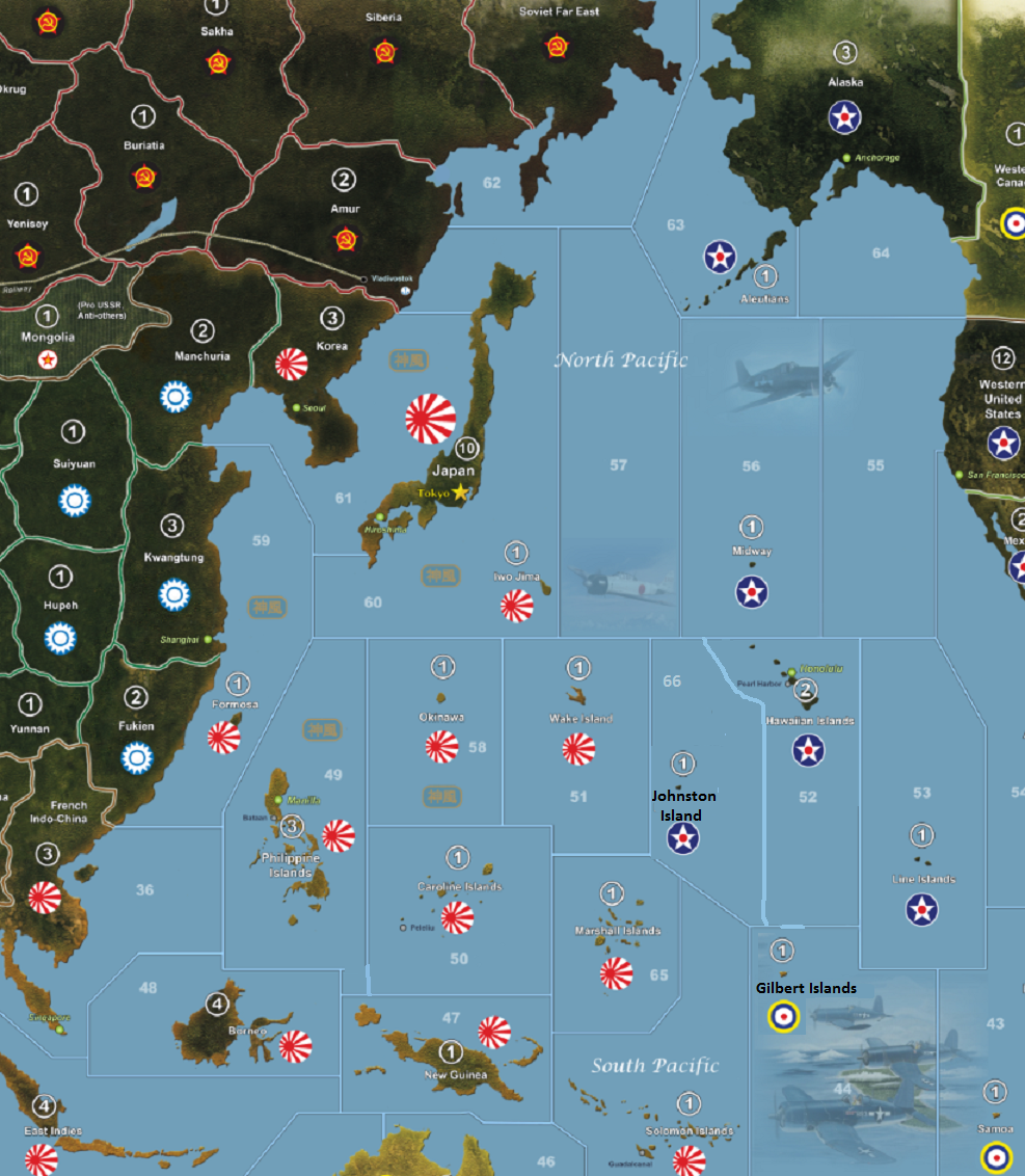
    However, enlarging Pacific SZs numbers and cutting, clearly would have an impact on PTO dynamics and time to invade Japan. I’m curious, AA50 map was already large, and you partly use Spring 1942 too. Do you feel like Pacific in 1942.2 map would be better?

    Hawaii is 3 SZs away from Japan. In Spring 1942, it is only 2 SZs from Japan. Is it your main issue you feel about Pacific SZs?

    I also like that you put Iwo Jima into same SZ as Japan. It is a distinctive feature of your map which I only found in the smaller 1941 map. What was you reason for not following AA50 or 1942.2 maps on that one?

    As far as I understand, you followed 1942.1 SZs in Pacific.
    This map makes for same distance path from Japan to Borneo Celebes (2 SZs) or Dutch East Indies (Java, Sumatra) (3 SZs), as it is to reach Hawaii (2 SZs) or USA West Coast (3 SZs).

    Is it what bother you?
    Japan cannot defend efficiently nearby Islands on this map compared to 1942.2 (in which Philippines is the shortcut toward both New Guinea or Borneo within 2 SZs move).
    Solomon Islands, Australia and New Zealand are quite far on your map: 3 SZs, 4 SZs, 4 SZs.

    On 1942.2, it is 3 SZs (Australia) and 4 SZs (only for New Zealand).
    Somehow, it makes me think this map SZs are more dynamic than previous from 1942.1 and AA50.
    Mainly because of Philippines SZ (adjacent to Japan SZ) short-cut toward New Guinea.


    Do you have any reason to put Lines Islands east of Hawaii in SZ53 instead of due South in SZ44?

    Fiji SZ42 and Samoa SZ43 are well placed, for game purpose.
    If SZ44 is empty, Fiji would be better in SZ44, but Lines Island is a better fit for SZ44.

    A 1 IPC Johnston Island could also be added on your map into SZ44 and leaving Lines Islands in SZ53 (pretty organized in the same pattern as in G40 Pacific map).

    Looking for a SZ54 candidate?
    Galapagos Islands are just in this SZ. These would make an interesting way point, toward Panama or South America, too.

    DKs Hybrid PTO SZs.png

  • '17 '16

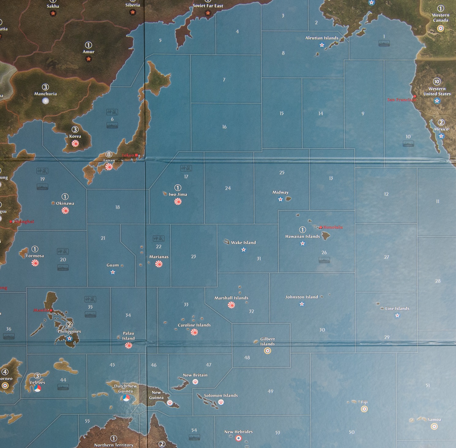
    Unless there is some features you like in Pacific 40.2 map?

    West Coast SZ is 4 SZs away from Japan and Hawaii is only 3 SZs from Japan, but 2 more to reach West Coast SZ.
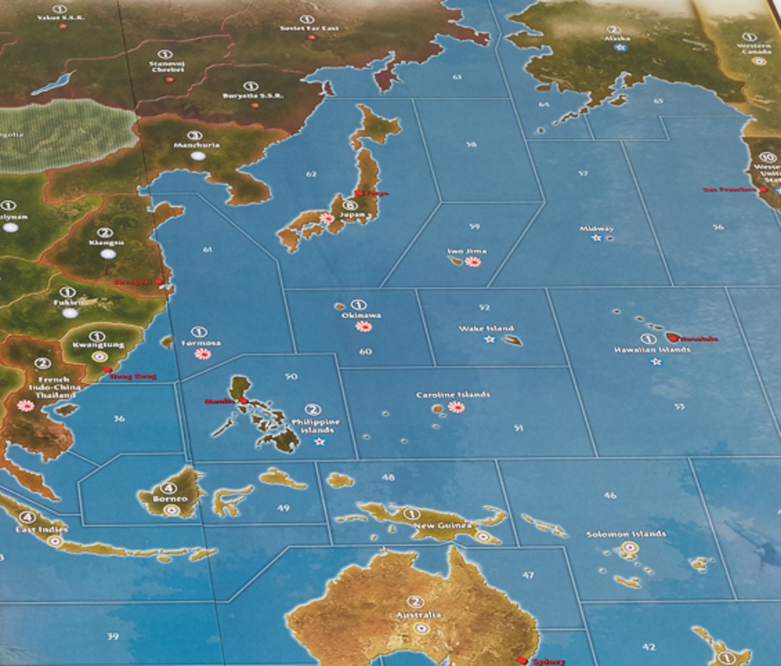
    In AA50, Hawaii and US West Coast are 3 SZs away from Japan.

    AAPacific 40 boardmap_eastern part.jpg
    axis-allies-anniversary-3_Pacific SZs.jpg


  • Excuse me but this is essentially my map with a few crude edits. It is not any other.

  • '17 '16

    I knew that DK’s basis was your map, as it is written on DK’s hybrid map credit.
    “Original Artwork: Imperious Leader, Adaptation: Der Kuenstler”
    So, what is your point?

    I was not that deep into these maps comparisons as going from yours to DK’s hybrid to see differences.
    Actually, I was just comparing official AA maps with DK’s hybrid.
    I just realized his Pacific SZs is based on Spring 1942, not AA50.
    But, as far as I know, your map was based on AA50.
    That is where I am in my understanding of maps.
    I was not deeper in my analysis, it takes time to see all details and changes.

    OK, I found your maps.
    It seems DK’s put together your AA50 Continental map with your Spring 1942 SZs map.

    But, it seems DK gave a lot of love and passion onto your basic final maps, too.
    Of course, without your map, he would not get such hybrid map where it is now.

  • '17 '16

    DK, looking deeper at your Pacific SZs map, maybe it is just a question of slightly moving Marshall Islands SZ65 to the West, and leaving space to move IJN from Japan directly through Wake Island SZ51 to Solomon Islands SZ45.
    That way, US Navy would have to move from Hawaii SZ52 through Wake SZ51 or Solomon SZ45 to reach your home-made SZ65 Marshall Islands.
    This would also emphasized the historical importance of fighting for Solomon Islands.
    So, Wake and Solomon would be part of an outer defense perimeter.

    Also, IJN from Philippines SZ49 would be able to reach Solomon SZ45 in 2 moves instead of 3 moves by connecting SZ49 to New Guinea SZ47.
    **By tweaking slightly these two, SZ49 & SZ65, it will recreate 1942.2 SZs dynamics without making an overall redraw of your hybrid map based upon 1942.1 PTO SZs.

    Since you were able to change wholly a Chinese TT and much more in France, you have an opportunity to make many play-tests for much lower cost.**

    Of course, I’m making a guess about what is not working to your taste.
    But, this SZ65 (and SZ49, too) is probably related with New Zealand not being very active, as you put in your last game report 21 October 2017 at about 21 min 30 sec. (It was 3 SZs from Japan, in the original map SZ; actually it is 4 SZs from Japan.)

    Let me know.

    DKs Hybrid PTO SZ49 SZ65 modified.png

  • '17 '16

    You said you would like to enlarge Pacific.

    Is it something like this you have in mind?
    Another SZ66 (Johnston Island)?
    More distance (3 SZs) between Japan and Hawaii?
    Keeping all actual SZs border.
    I added Gilbert Islands in SZ 44.
    However, I would change Philippines SZ49 to reach New Guinea (as in 1942.2 map).

    DKs Hybrid PTO SZs_enlarged PTO.png

  • '17 '16

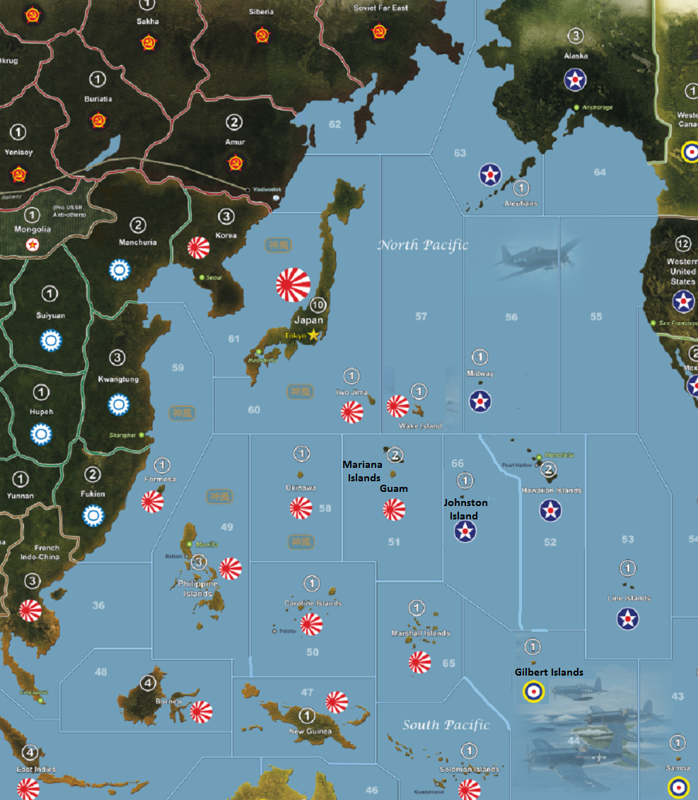
    Here is another map which add Guam or Mariana Islands and still keep a somewhat accurate geographic position.
    Wake Island has been put northward into SZ57.

    If you wanted more island TTs in PTO.
    Due to strategic importance of Mariana Islands and Guam, I would even rise the value of this TT to 2 IPCs (Japan). So, the Islands hopping and Marianas Battle (or Great Marianas Turkey Shoot) make sense in this game too. And also for balance purpose, adding 1 IPC Johnston Island (US) and 1 IPC Gilbert Islands (UK).

    I also modified the Gilbert Island SZ44 borders, so it makes more sense that IJN captured them at the beginning of the war against USA. It better illustrates the Outer Defense Perimeter of Japan.

    I even played on the geographic positioning of islands.
    It gives a better view of where are each TT.

    DKs Hybrid PTO SZs_enlarged PTO_Guam.png

  • '17 '16

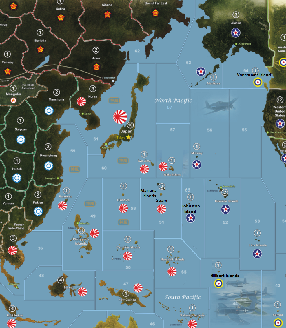
    This last ones is adding a 1942.2 North Pacific SZ67 and making much straighter SZ, but same as above.
    I also modified the Korean SZ61.
    That way, it will get directly to Soviet Far East SZ62, same as 1942.2.


    I even push a bit forward, for my pleasure by adding 1 IPC Vancouver Island in between 2 SZs : SZ64 and SZ55, and if captured, allows Japan to launch Fighters from this island into West USA or Western Canada.

    DKs Hybrid PTO SZs_enlarged PTO_Guam 1942 2nd.png
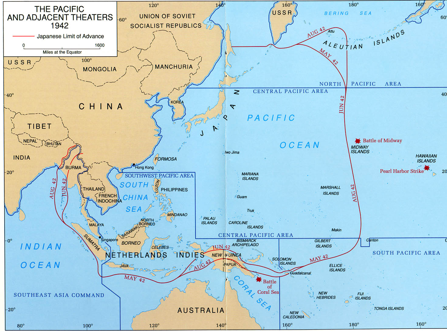
    Pacific_WW2_1942_Japanese advance.jpg

  • '17 '16

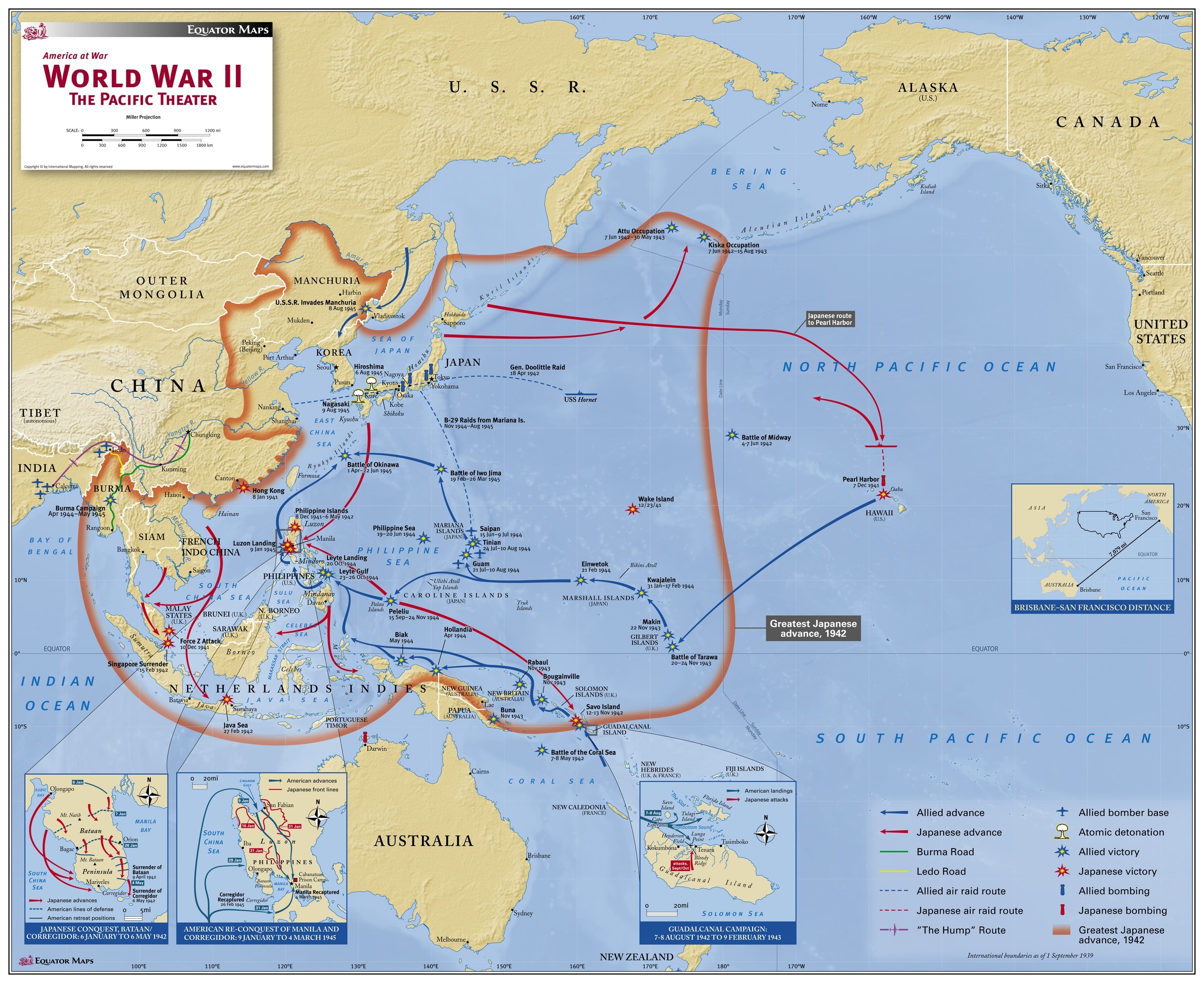
    This map is by far the better to see US advance toward Japan in PTO.
    All important Island locations are noted.

    world_war_ii_the_pacific_theater.jpg


  • So who and what map has the correct Burma Road on it ? This map shows the road only in Burma and going to Chungking which is above Yunnan and not going to Sezhwan.
    So then all game board maps are wrong ?

    I’m assuming they are changed for game play purposes ?

  • '17 '16

    You seems on the look out SS.
    A real watchdog.
    It needs further investigation, which source is accurate?

  • '17 '16

    @SS:

    So who and what map has the correct Burma Road on it ? This map shows the road only in Burma and going to Chungking which is above Yunnan and not going to Sezhwan.
    So then all game board maps are wrong ?

    I’m assuming they are changed for game play purposes ?

    The previous map seems correct. It reveals that delivery from Calcuta to Chungking was by air transports.
    And road shipping was by rail first, then road toward Yunnan regional capital.
    There is many particularities according to the time war.

    Probably the simplest way is to consider 4 TTs for gameplay purpose.


  • @Baron:

    @SS:

    So who and what map has the correct Burma Road on it ? This map shows the road only in Burma and going to Chungking which is above Yunnan and not going to Sezhwan.
    So then all game board maps are wrong ?

    I�m assuming they are changed for game play purposes ?

    The previous map seems correct. It reveals that delivery from Calcuta to Chungking was by air transports.
    And road shipping was by rail first, then road toward Yunnan regional capital.
    There is many particularities according to the time war.

    Probably the simplest way is to consider 4 TTs for gameplay purpose.

    I did some checking to. Its the Ledo Road that connects the Burma road to India. the Ledo Road wasn’t built until 1945. As you stated there is many particularities.  So if it goes through 4 territories then it should be called The Ledo/Burma Road. IMO

  • '17 '16

    Your right about this Ledo road:

    The Ledo Road (from Ledo, Assam, India to Kunming, Yunnan, China) was built during World War II so that the Western Allies could supply the Chinese as an alternative to the Burma Road which had been cut by the Japanese in 1942. It was renamed the Stilwell Road (named after General Joseph Stilwell of the U.S. Army) in early 1945 at the suggestion of Chiang Kai-shek. It passes through the Burmese towns of Shingbwiyang, Myitkyina and Bhamo in Kachin state.

    One interesting fact about land road is that it cannot compete with the airways:

    As General Chennault had predicted, supplies carried over the Ledo Road at no time approached tonnage levels of supplies airlifted monthly into China over the Hump. In July 1945, the last full month before the end of the war, 71,000 tons of supplies were flown over the Hump, compared to only 6,000 tons using the Ledo Road; the airlift operation continued in operation until the end of the war, with a total tonnage of 650,000 tons compared to 147,000 for the Ledo Road. By the time supplies were flowing over the Ledo Road in large quantities, operations in other theaters had shaped the course of the war against Japan.

    http://military.wikia.com/wiki/Ledo_Road

    So, from gameplay POV, when Axis is owning a given TT from the Burma road, it is a way of acknowledging that airlift transports are no more possible over a given portion of Burma Road. (Too much AA guns… and too long flight.)

    Also, Kunming in Yunnan was the delivery point, but it does not mean the material is given to Chinese soldiers and divisions. Hence, the addition of Chungking in Szechwan, as the capital-in-exile of Republic of China, where we presume are the training grounds and division camps to built their armies.

  • '17 '16

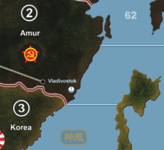
    Another strange thing on DK’s Hybrid map: Vladivostok is a seaport and is the end of Trans-Siberian Railways.
    But they are not connected?!!

    Maybe it had something to do with the passing too near from name in white letters, and altering the underlying pic.

    DKs Hybrid Siberia and Vladivostok.png


  • @Baron:

    Your right about this Ledo road:

    The Ledo Road (from Ledo, Assam, India to Kunming, Yunnan, China) was built during World War II so that the Western Allies could supply the Chinese as an alternative to the Burma Road which had been cut by the Japanese in 1942. It was renamed the Stilwell Road (named after General Joseph Stilwell of the U.S. Army) in early 1945 at the suggestion of Chiang Kai-shek. It passes through the Burmese towns of Shingbwiyang, Myitkyina and Bhamo in Kachin state.

    One interesting fact about land road is that it cannot compete with the airways:

    As General Chennault had predicted, supplies carried over the Ledo Road at no time approached tonnage levels of supplies airlifted monthly into China over the Hump. In July 1945, the last full month before the end of the war, 71,000 tons of supplies were flown over the Hump, compared to only 6,000 tons using the Ledo Road; the airlift operation continued in operation until the end of the war, with a total tonnage of 650,000 tons compared to 147,000 for the Ledo Road. By the time supplies were flowing over the Ledo Road in large quantities, operations in other theaters had shaped the course of the war against Japan.

    http://military.wikia.com/wiki/Ledo_Road

    So, from gameplay POV, when Axis is owning a given TT from the Burma road, it is a way of acknowledging that airlift transports are no more possible over a given portion of Burma Road. (Too much AA guns… and too long flight.)

    Also, Kunming in Yunnan was the delivery point, but it does not mean the material is given to Chinese soldiers and divisions. Hence, the addition of Chungking in Szechwan, as the capital-in-exile of Republic of China, where we presume are the training grounds and division camps to built their armies.

    Makes sense. I’ll just leave on map as is. Will connect Yunnan to the Burma road. The UK still can transport 2 ground if Ledo road is open to Burma. Monsoon weather event restricts motorized units from moving in certain territories. Inf only can move for either side. I’m out of this thread now. Don’t want to jam up DK’s thread.


  • @SS:

    I did some checking to. Its the Ledo Road that connects the Burma road to India. the Ledo Road wasn’t built until 1945. As you stated there is many particularities.  So if it goes through 4 territories then it should be called The Ledo/Burma Road. IMO

    The Burma Road started out as the Burma Road.  Once Japan conquered Burma, however, the southern end of it became unusable by the Allies, so the Allies had to build a new road connecting India to the middle part of the old Burma Road; it became known as the Ledo Road from that point onwards.


  • @Imperious:

    Excuse me but this is essentially my map with a few crude edits. It is not any other.

    And what exactly did I do to deserve this? I’ve been nothing but thankful and respectful to you for letting me adapt your map, IL - stuff like this is why I barely visit this site anymore. Isn’t your 1942 map pretty much an EXACT copy of an already published retail map, just made prettier?

    This is supposed to be a thread about a map that I adapted. It is what it is - all faults included. Nobody is forced to visit here if they don’t like it.


  • Relax, somebody said " Der Kuenstler your map is great " and i said its not his map. Thats it. Why you bugging out?

    And the funny thing is is that that posted edited out that portion of his remark so i cant even show you what he said… :roll:

Suggested Topics

  • 1
  • 5
  • 1
  • 20
  • 9
  • 36
  • 11
  • 6
Axis & Allies Boardgaming Custom Painted Miniatures

60

Online

17.0k

Users

39.3k

Topics

1.7m

Posts