I’ve created a separate thread for my work on the OOB 1914 map. Please go here to discuss it in more detail.
Propaganda Map
-
For those of you wondering how the game’s going to end up if you take me on while I control the Central Powers…. 8-)
But we leave Italy alone…because we like pasta too much. :-D
-
And it’s nice to leave Romania as is, if only to have someone to beat up if you get bored.
-
I like that “baby” France by Spain. Turned France into Andorra part II
-
Also like how Ireland is an Austro-Hungarian Colony :lol:
-
these hysterical french… they kept showing this “german” war goals
even after the germans made an peace offer without annexions in 1916
just to keep their allies in fighting. -
Where is that from?
-
Where is that from?
Looks like an old newspaper. Just was googling ‘WW1 maps’ to get a look at the feel of period maps for a custom one I am creating.
P.S.: Can someone translate the French at the bottom?
-
Ireland an Austro-Hungarian colony.
Oh god my sides :-D -
P.S.: Can someone translate the French at the bottom?
I’ll do so after work, but for now I’ll just mention that the item is headed by the phrase “what defeat would have cost us.” That and the rest of the text suggests that this is a post-war map.
-
It says:
"The dream of German hegemony – What defeat would have cost us
We publish above, based on the Daily Mail, a map which sums up the German projects to rearrange Europe after the war, and which shows what we would have become if the German blow had succeeded.
Belgium, Luxembourg, Serbia and Montenegro disappear completely. Russia loses all of its Baltic provinces along with Petrograd. Great Britain becomes an Austro-Hungarian colony. As for France, she is reduced to the department of the Lower Pyrennes, with Bayonne as its capital."
So this is a post-war map, and it’s either reproduced (in French translation) from the Daily Mail or it’s based on information found in the Daily Mail. So you could call it a Franco-British co-production.
-
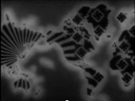
Here are two even more ambitious “war aims” maps from Frank Capra’s “Why We Fight” series of propaganda films.
Ironically, though Frank Capra probably wasn’t even aware of it, Germany and Italy and Japan did in fact sign a secret protocol which divided the world into spheres of influence between them, with the dividing line placed in the Indian Ocean and with the two zones extending east and west from there up to the west and east coasts of the American continent. It’s discussed in the book “Reluctant Allies: German-Japanese Naval Relations in World War II”. You can see the demarcation line here:


-
Can’t fix the link in that last message. Â I’ll try to post it separately:
[Edit] Nope, that didn’t work either. It’s in the Wikipedia article called “Axis powers” in the “German, Japanese and Italian World War II cooperation” section.
-
That is awesome. If somebody wants to write a strategy for this game for the Central Powers, I’ll use that map as the lead photo.
-


