


UPDATE: Added an overlay that redraws the border between sea zone 37 and 38, uniting the Andaman Sea and the Malacca Strait and causing SZ 37 to border Sumatra for the first time.
alt text
Very cool idea!
I love the pics of leaders on map. Sweet !
Nice!
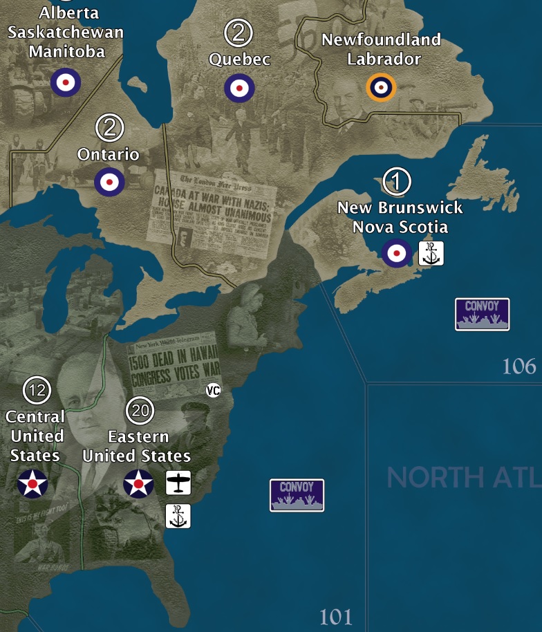
Update:
Pacific Islands are done.
North America still a work in progress.
Cheers,
D
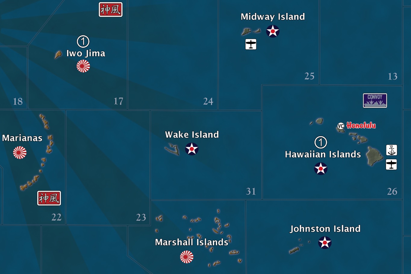
Just noticed I forgot the airbase for Wake. Oops. :roll:
Awesome idea!!!
Very, Very, Cool… thanks for sharing.
Brilliant idea! Looking forward to see the end result.
Greetings from Mid-Michigan, USA.
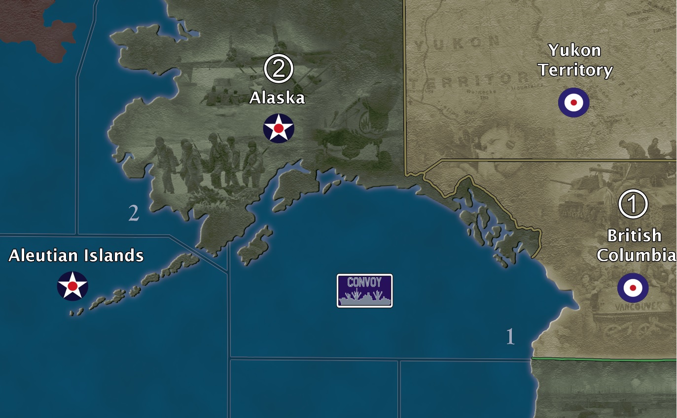
I’ve managed to “fix” the Alaskan-YT-BC border along with making the Aleutian Islands look a bit better. I realize that this is just a board game, but that OOB border for Alaska was bugging me too much. I just had to fix it. It’s not completely accurate but I think it looks much better than the OOB rendition.
Since my last post, I decided to give each Capital City a unique identifying icon. For London, its Big Ben of course. All of the capital city icons will be of the same art style so it will be consistent. Victory Cities that are not capitals will all have just a simple “VC” icon. All victory cities including capitals will be written in a unique font consistent with that particular nation/city’s traditional style. All airbase icons will have a unique aircraft silhouette. For example, UK airbases will have a Spitfire silhouette. Some players will take notice of that, and some won’t, and then others won’t even care. But it was easy enough to do so I went ahead and did it.
Also, as you can see from the images, I edited the border between Scotland and UK to give a more “accurate” border (plus the original border was crossing Winston’s forehead and I didn’t like that!). That required me to adjust the sea zone borders.
Cheers,
D

Greetings,
Did you ever finish your map?
If so, can you share with community?
I am in process of selecting a map to print, and yours embodies much of what I am looking for in a map.

