


Locked in favour of https://www.axisandallies.org/forums/topic/42370/
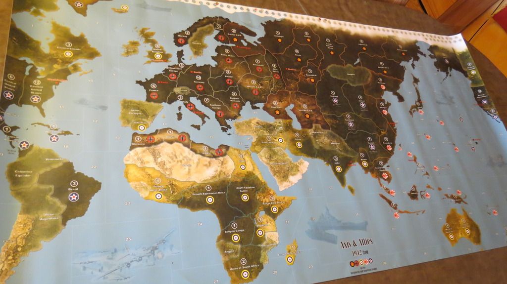
Supreme map 1942 ed 2
-
Final version 4 of 5
Map: 1625x863mm, triple border design, with Mobilization Zone and with National Production Chart
- So far no additional feedback received concerning the latest version of the map
- Checked again all borders, seazones and territories
- corrected one border (missing border between Southern Europe and Italy)
- 3 graphical errors corrected
Here is the link to the hopefully last version of this map:
http://www.mediafire.com/view/8z2ncptrkbn3xtl/1942_ed2_triple_border_-MZ-_-NPC-.pdf -
As i said for the 1941 map, thanks to you. It only took me one or two hours to check all the things, nothing compared to your work. :wink:
Hope this is the final version !
For the german insigna, i will upload a snapshot. I won’t be out without internet like the last three weeks, so i will be able to reply faster :-) -
Ok, here is the explanation of the “weird” german insigna : we checked the maps on my girlfriend’s computer (os Linux, software to read PDF Evince)
Here is what we saw at 100% zoom :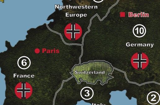
Today i opened the file with my computer (OS Windows 7, software to read PDF Adobe Reader
Here is what we saw at 100% zoom :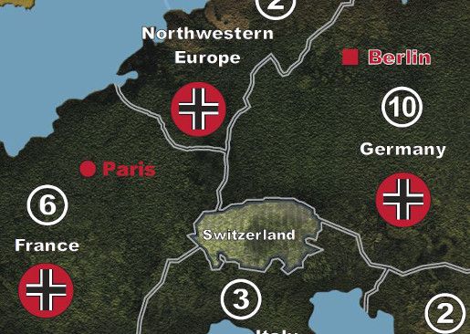
Can’t explain why. I hope the printing will show the good one !
-
Well, the explanation could be: do not trust a computer of a girlfriend…
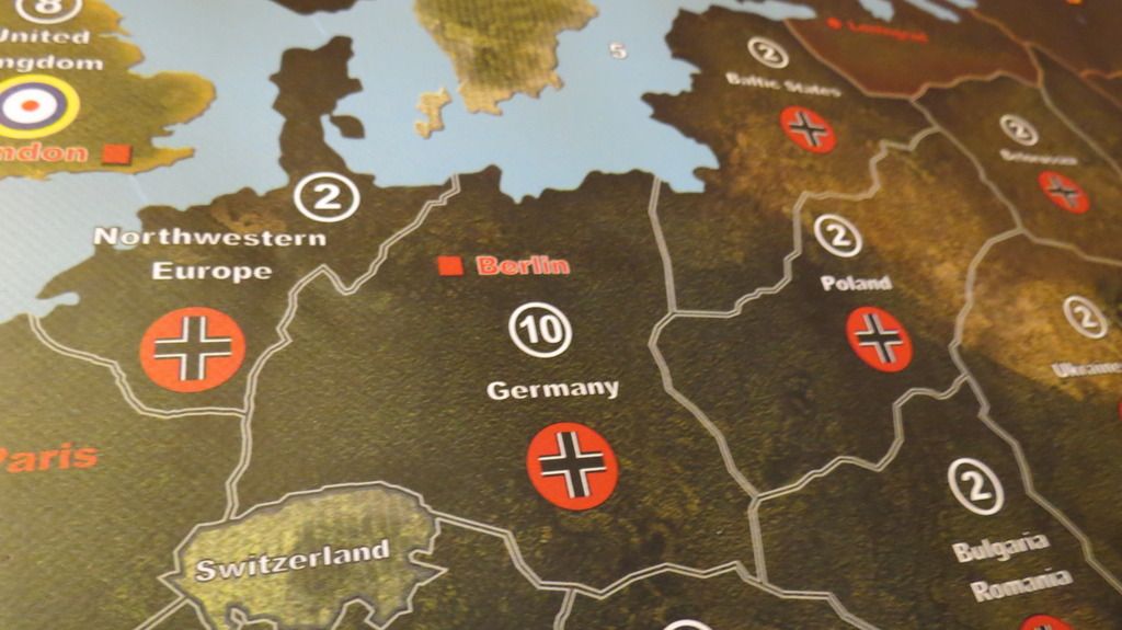
Joking aside, I don’t know the reason, why the map is displayed in a different manner: may be, it depends on an appropriate PDF-Reader (version?). However, I’m totally convinced that the map will work as I already have got a printed version, where the insignia are depicted correctly. Apart from that: the insignia is one “piece”, that is, it is not consisting of a set of elements (e.g., black lines, white lines, red circle). -
I suggest you test print a small section of the map on your printer. Most likely also the adobe reader is not the latest version, and third that computer may have to need the video driver updated.
-
There is one thing i hadn’t noticed but the MZ chart is near Africa and that gives a overcharged mass, graphically speaking, of the map. I think it would really be improved if it was placed in sea zones 41, 42 and 43. That would be more balanced, and it would look like the original map. You’d be my hero if you could make the changes on the different versions. :mrgreen:
-
A little up, just in case Dedo is around…. :-)
-
Final version 5 of 5
Due to special wishes from a very special community…
one additional, final map:- double border design
- Mob Zone in the South Pacific
- B-17 Squadron picture in the South Atlantic
-
A thousand thanks to you Dedo :-)
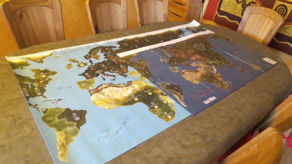
I will receive it on wednesday and post some photos. -
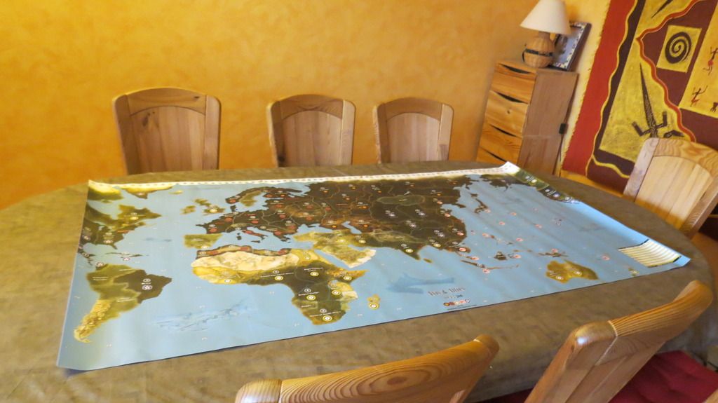
Here is the final result : perfect :lol:
-
Happy for you! I must admit, nice result! First appearance of the B-17 formation, have some fun and nice games!
-
Happy for you! I must admit, nice result! First appearance of the B-17 formation, have some fun and nice games!
Thanks again for everything. Your work is excellent. Played twice on the giant map, a pleasure, like a dream come true :lol:
-
Amazing job guys, love how a colaberation of skills can produse great work!
I will be printing this for sure, perhaps next winter after my bunker renovations, I love how you corrected many of the graphic flaws that I had issues with.
Cheers.
-
Thanks, but more than 95% of the work…comes from Dedo :wink:
-
Thanks, but more than 95% of the work…comes from Dedo
Don’t hide your light under a bushel, it’s extremely important to clear the faults otherwise one would chafe at the printed map when detecting the faults (in my first printed map I mixed up Western and Eastern Australia, it was an ongoing amusement to my game partner, an air traffic controller, to explain the difference between western and eastern again and again…).
-
I will be printing this for sure, perhaps next winter after my bunker renovations, I love how you corrected many of the graphic flaws that I had issues with.
@ YG, thank you very much, my pleasure!
BTW, good to know you with the 42.2ers! -
Just want to say thank you for the work on this, i printed it out at home, so much better than the oob and so much room…. grin The only issue i had was the seazones tended to blend. It may have been my printer, but anyway i will fix it with permanent marker. Thanks again
-
Insert Quote
Just want to say thank you for the work on this, i printed it out at home, so much better than the oob and so much room…. . Thanks againThank you very much, DM!
-
The only issue i had was the seazones tended to blend
What do you mean exactly? Is there a blending A) between the seazones (seazone borders between seazones are problematic) or B) within the seazones (bleeding of colors)? However, in the most cases, problems of a print out are related to the printer. If your computer screen shows you an accurate picture or graphic, the print out should be of the same quality (depending on the printer…).
A) When I remember right, the seazone border colors are predominantly white. Most of the standard printers (99%) do not print white. For example, try to print a white bar or something like this on colored paper, probably it will not work.
B) Bleeding: When I printed parts of the map the first time, I couldn’t find any bleedings. Again, bleedings may depend on your printer (I used a color laser printer). If you print the map on a standard printer, you should use the best solution and print quality possible.
-
the line between the seazones, as i say cheap printer, easy fix though.
Suggested Topics

