


Thanks! Will do.
My Next Map Project
-
Here’s a rough sketch of a Med map. This map would use all of the military units and be much more strategic in scale:
Your map includes the Straight of Gibraltar and the Dardanelles (the western and eastern exits/entrances of the Mediterranean), so you might want to add the third available route: the Suez Canal. It would lead “off the board” like the other two depicted exits/entrances do, and could be used in the same way as whatever you have in mind for Gibraltar and the Dardanelles.
-
Here’s some more work on a Med map:
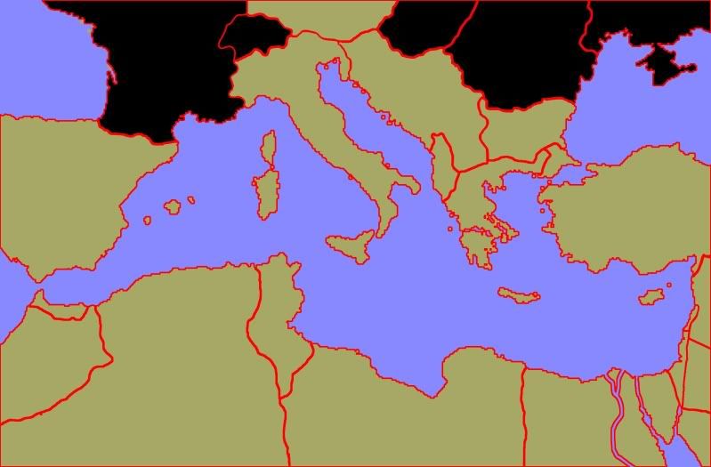 The blacked out countires are not going to be involved in the game and will probably be used to contain charts and info eventually.
How does this look?
-
Here’s some more work on a Med map:
The blacked out countires are not going to be involved in the game and will probably be used to contain charts and info eventually.How does this look?
Your using Spain and Turkey?
-
Israel does not exist before 1945, but you drew it in. Check out a map for this period for corrections.
-
@Imperious:
Israel does not exist before 1945, but you drew it in. Check out a map for this period for corrections.
But why would I need to check a map when I have your brilliant advice delivered in such a non-derisive manner.
Thanks, changes underway.
-
But why would I need to check a map when I have your brilliant advice …
Because i don’t have time to look at everything carefully. Israel just came off the picture immediately as being incorrect for 1939-45 game.
But also some minor changes should go to the areas around Hungary and Romania, because Germany reconfigured some of the borders and added some to others and took away some too from conquered nations. But generally it looks ok except for Israel.
-
I feel like you should make Vichy France possible to invade. If you can invade the French African territories, they should all me treated as one entity.
-
@Imperious:
But why would I need to check a map when I have your brilliant advice …
Because i don’t have time to look at everything carefully. Israel just came off the picture immediately as being incorrect for 1939-45 game.
But also some minor changes should go to the areas around Hungary and Romania, because Germany reconfigured some of the borders and added some to others and took away some too from conquered nations. But generally it looks ok except for Israel.
No I think everything else is right, but I am not sure.
-
Holden if you were too make a Stalingrad game, like you drew the map up for I think it should be closer down too the city with a city block as a territory. You could also use table tactics new pieces to represent different infantry units. Other ideas would be transport bouts that could be stat bombed and soviet rockets.
-
@Imperious:
Israel does not exist before 1945, but you drew it in. Check out a map for this period for corrections.
The country of Israel didn’t exist but the territory was there back then. It was called Palestine pre 1945.
-
@Imperious:
Israel does not exist before 1945, but you drew it in. Check out a map for this period for corrections.
The country of Israel didn’t exist but the territory was there back then. It was called Palestine pre 1945.
And some of it still is
-
How is the map doing anyway? I thought Stalingrad would be cool but I’m interested in the result of the meditarrian map.
I’m also trying to create a game using A&A pieces in Australia and New Zealand called Thunda down unda. Ideas and critiscims are welcome.
-
i voted Kursk, but stalingrad, north africa and Market Garden would be cool either
Suggested Topics

