


@GEN-MANSTEIN said in Huge maps:
Possible. I would perfer a slide out drawer of some sort. Then push back in under the dice box. You can make dice box smaller too and have same roll out drawer for sides.
Yes, that’s a good approach too.
Working on Inkscape to customize a map. Here is Italy so far. There is little cosmetic things that need adjusting but its a start. Any suggestions?
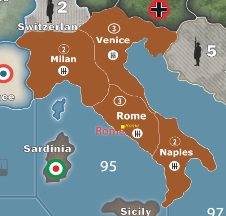
Gorgeous bgugs!!! Keep it up.
Mr. Tricorder, you said you have used inkscape before. When working on this map it began placing white squares anywhere I attempted to draw. It wasn’t actually placing the blocks there just displaying them. What I mean is it would still draw the color I wanted where I wanted but would display a big white box over where I was attempting to draw until I zoomed either in or out. Because of this I tried to save my work and reopen it and see if that would work. Now when I reopen the file there is nothing there, not the original map or the map plus my edits. Any idea what may have happened?
Here’s a look at how Western Europe is coming along
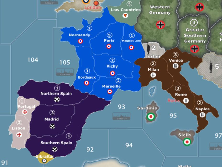
bgugs, that looks awesome! Great job on this. :-)
Thanks. I am trying for a more complex map with likely more complex house rules applied to a variant game. It likely will not be welcomed by many gaming groups but a game with more complexity and more variability fits my groups desire so that is the way I am going with my project.
Thanks. I am trying for a more complex map with likely more complex house rules applied to a variant game. It likely will not be welcomed by many gaming groups but a game with more complexity and more variability fits my groups desire so that is the way I am going with my project.
I here you. The more variants, the better for the community. :-)
You should consider adding Reims/Dunkirk to your map, bordering Low Countries (Belgium). A 1 shot deal into Paris is kinda defeating the purpose of your map
That’s still something I am torn on. I am worried about spacing and not making Europe overly crowded in certain territories, and I was kind of looking at making Germany have access to almost all of France once they conquer Belgium (much like they did in real life). I am still working on it and that is still something I am considering though
North Africa and Great Britain
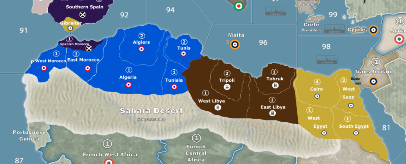
North Africa and Great Britain
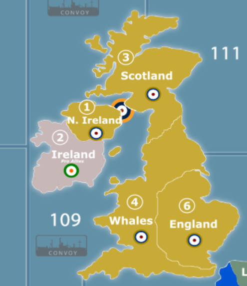
Nice maps. The Great Britain one, incidentally, should say Wales, not Whales.
That’s embarrassing, didn’t even notice that. Thank you!
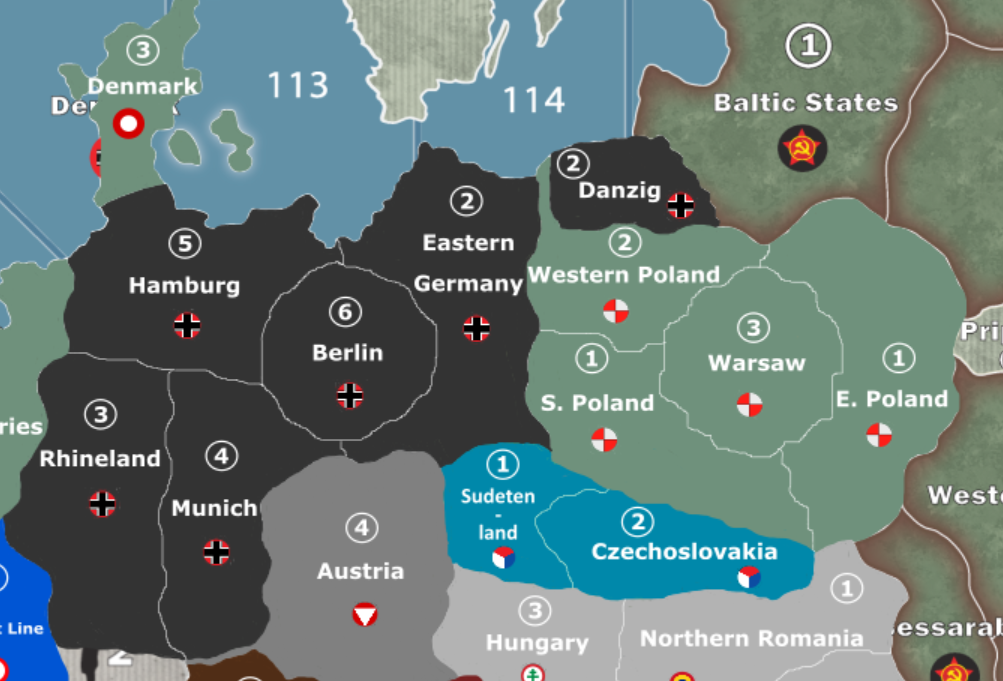
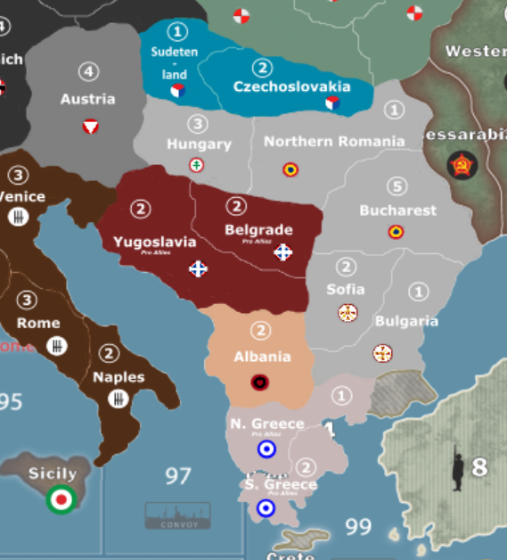
Been a while since I shared on here due to being busy and not having a lot to share, but here is Germany/Poland/Southern Europe
Mr. Tricorder, you said you have used inkscape before. When working on this map it began placing white squares anywhere I attempted to draw. It wasn’t actually placing the blocks there just displaying them. What I mean is it would still draw the color I wanted where I wanted but would display a big white box over where I was attempting to draw until I zoomed either in or out. Because of this I tried to save my work and reopen it and see if that would work. Now when I reopen the file there is nothing there, not the original map or the map plus my edits. Any idea what may have happened?
I’m very sorry. I haven’t visited this thread in a while and didn’t see your question until just now. I haven’t used inkscape in years though, so I don’t know what’s going on there. I have an Adobe Creative Cloud subscription, so I do all my vector-based artwork in Illustrator now. If you’re still having this problem, I would recommend checking out the inkscape support forums.
Not a problem. I was speaking to panther about the problem when it suddenly fixed itself. So now everything is working great
This project is not forgotten or given up on. I have made some great progress in the pacific so far. However, due to repeated issues with inkscape and the fact that I have basically had to redo all my work a few times, I am going to look to switch over to adobe programs. Once I have more figured out I will share the progress I have made
you can also look at Affinity products.
They have a PS and Illustrator replacement.
Cheaper and no subscriptions.
Caveat is they are newish and are not as chrome laden as adobe stuff.
But for this job, they would work fine.
This map looks really great! Love to see this progressing
Robert have you worked with Affinity’s designer program? It seems nice, but since it is new I just want to make sure I am not spending $50 on something that will be riddled with bugs
I’ve dabbled in Affinity designer and photo. I use Adobe Illustrator now for work but am slowly learning designer as it probably will replace AI in the future. I won’t pay Adobes software ransom demands.
Designer has been going since 2014 so it does have growing pains trying to get on par with Illustrator. ( I won’t say it is riddled with bugs, just not as feature rich as AI )
Photo on the other hand is a viable PS replacement. (more money in creating a PS app than a vector app)
That said, it should work fine for most if not all your needs.
Really though, there is no other alternative AI when doing large files/maps.
If you are not in a hurry, check the app store on major holidays as these do go on sale. I think I got mine on the July 4th or Black Friday sale.
Hope this helps.
Robert


