


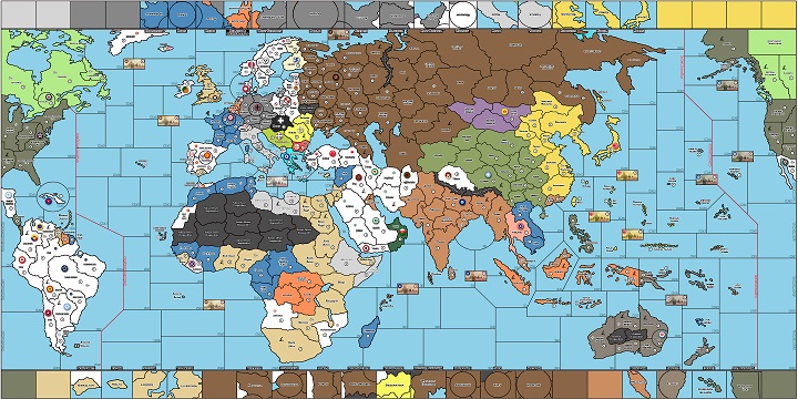
Im not talking about a digital Map, but a real one. I consider myself very artistically minded so I think I could do it without it looking too bad. What materials would I need, how much time would it take? I wanna do a global map from about 1920.
Custom Map
-
Hey axis and allies community. I was looking at playing around with creating my own custom map. I wanted to used Imperious Leaders G1940 map as a template (see the attached link). I currently have paint as an editing program but can’t seem to convert the file. So the first question I have is, should I be using paint as a program, and if so can someone try their luck at converting it, or just tell me I am being dumb and what I did wrong? If paint is not a good option, what recommendations do people have? Thanks guys
https://www.dropbox.com/s/xusl1zi7d1h2qt0/Full AAG40 Map2.pdf?dl=0 -
Ive made Custom Maps using Paint. You are just limited in Colors and Effects.
Combat Miniatures, custom pieces for your A&A games.
-
I’m pretty sure you’d want to use almost anything but Paint. I only use Photoshop, but that’s a steep investment and without serious experience as a digital artist probably overkill.
GIMP is free, and generally well-regarded. I know I’ve also used Pixlr in a pinch, but not sure how large of files it can handle.
Google is your friend, I’d search “best free Photoshop alternatives”
Photoshop and GIMP are great for editing existing images like photos and other artwork, but if you want to create something like a new map from scratch, I would recommend using a vector-based program instead. Unlike Photoshop which is primarily geared towards modifying and compositing existing images, these programs are designed specifically for creating complex images from scratch. Also vector graphics are scalable, so you can adjust or resize whole images or individual image elements without any apparent loss of quality.
Adobe Illustrator is the obvious choice here if you have access to/can afford Adobe products, but if you’re looking for a free option then I would highly recommend Inkscape. It’s a very lightweight but powerful vector graphics program that you can download it and use for completely free at https://inkscape.org/en/.
-
I downloaded inkscape and it looks like once I figure out how to use it, it should serve my purposes. Thanks guys for the help. Hopefully in due time I will have a cool map to share
-
I’m pretty sure you’d want to use almost anything but Paint. I only use Photoshop, but that’s a steep investment and without serious experience as a digital artist probably overkill.
GIMP is free, and generally well-regarded. I know I’ve also used Pixlr in a pinch, but not sure how large of files it can handle.
Google is your friend, I’d search “best free Photoshop alternatives”
I’ve been using GIMP and having good results with it. I have actually used it to modify Imperious Leaders maps. It’s still a big work in progress. But I have cleaned it up a fair bit. GIMP can be used to zoom in quite a bit, and edit a single pixel if need be.
-
I will look into GIMP as well. Thank you for the input. My schedule filled up quickly so I lost most of what I thought would be free time to paint and customize a map, but I am still working to do both
-
Bgugs Thanks for starting this thread. Answered the questions I had. Thanks also to the community for its helpful answers.
But now that I’ve started…downloaded inkscape and gimp.
Does anyone know what the recommendation resolution needs to be? Specifically for larger map sizes like 4feet by 8 feet, or another common sized map at 3feet by 6feet. I would like it to have the same crisp image as either HBG 1936 or A&A global 1940. Since a digital cameras starting resolution affects larger images drastically, I assume the same here. I’d rather not pay to print a substandard large map, just to toss it and print again! -
@Rank:
Bgugs Thanks for starting this thread. Answered the questions I had. Thanks also to the community for its helpful answers.
But now that I’ve started…downloaded inkscape and gimp.
Does anyone know what the recommendation resolution needs to be? Specifically for larger map sizes like 4feet by 8 feet, or another common sized map at 3feet by 6feet. I would like it to have the same crisp image as either HBG 1936 or A&A global 1940. Since a digital cameras starting resolution affects larger images drastically, I assume the same here. I’d rather not pay to print a substandard large map, just to toss it and print again!You always want to print at 300dpi (dots per inch) regardless of the actual dimensions of the map. Just about any serious graphics program should allow you to set up your image by dimensions in inches or millimeters and by dpi, and that will determine your resolution in pixels.
-
Affinity Photo (Raster app comparable to Photoshop) and Affinity Designer (Vector app comparable to Illustrator) are the closest things you can get to professional software without the monthly or otherwise outrageous costs…roughly $50 each but worth it if you plan on using programs like this on a semi regular basis. Mac or PC, very powerful for the price and not too difficult to learn.
Make your files 300 dpi+ for printing. To check the “crispness” from a printer, send them a small square (maybe 3"x3") of the map with a lot of detail inside and have them print it as a test and check the quality. That way if it’s crap you’re only out a few $.
-
Thank you both! Mr tricorder and dillankid
Thats perfect info! :-D
Lots of threads on other’s project maps. But precious few, on how to DIY a map, player aids etc. The more you know, the fewer mistakes explained for you to repeat. -
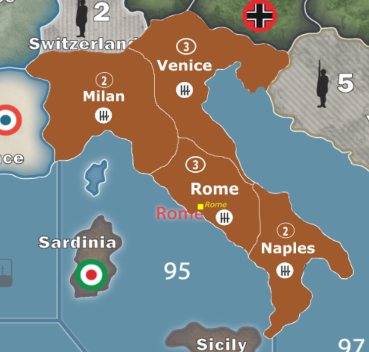
Working on Inkscape to customize a map. Here is Italy so far. There is little cosmetic things that need adjusting but its a start. Any suggestions?
-
Gorgeous bgugs!!! Keep it up.
-
Mr. Tricorder, you said you have used inkscape before. When working on this map it began placing white squares anywhere I attempted to draw. It wasn’t actually placing the blocks there just displaying them. What I mean is it would still draw the color I wanted where I wanted but would display a big white box over where I was attempting to draw until I zoomed either in or out. Because of this I tried to save my work and reopen it and see if that would work. Now when I reopen the file there is nothing there, not the original map or the map plus my edits. Any idea what may have happened?
-
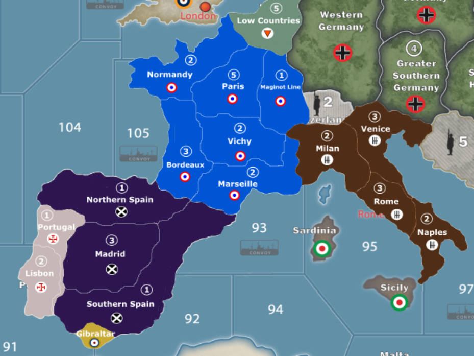
Here’s a look at how Western Europe is coming along
-
bgugs, that looks awesome! Great job on this. :-)
-
Thanks. I am trying for a more complex map with likely more complex house rules applied to a variant game. It likely will not be welcomed by many gaming groups but a game with more complexity and more variability fits my groups desire so that is the way I am going with my project.
-
Thanks. I am trying for a more complex map with likely more complex house rules applied to a variant game. It likely will not be welcomed by many gaming groups but a game with more complexity and more variability fits my groups desire so that is the way I am going with my project.
I here you. The more variants, the better for the community. :-)
-
You should consider adding Reims/Dunkirk to your map, bordering Low Countries (Belgium). A 1 shot deal into Paris is kinda defeating the purpose of your map
-
That’s still something I am torn on. I am worried about spacing and not making Europe overly crowded in certain territories, and I was kind of looking at making Germany have access to almost all of France once they conquer Belgium (much like they did in real life). I am still working on it and that is still something I am considering though
Suggested Topics

