


Sweet!
Oztea tries to make a map
-
I don’t want a space in the atlantic where the allies can unload transports while en route to europe. (so that if said fleet is attacked, the land units are safe on dry land)
I want the US to have to protect loaded transports as they cross the atlantic, but for it to take 2 turns at least.
Here is a pic of the temporary progress. Without seazones of course.
-
cool map so far, nice work oz!
-
LMFAO!!
For whatever reason everybody uses that background ghosted image from one of my maps. Triple A, and now this. It was originally a picture from part of Russia
-
Not “from your map”, just in the style of it.
Found the image on google image search and tiled it.Its not a “part of Russia” because it has places like “Richmond” and “Colonial Heights” labeled on it. Which you can see clearly, upside down, in northern Quebec.
The road map texture is a preferable alternative to the “terrain texture” of the 1940s map, and the “solid colors” of the 1939 Global map.I might tone back the opacity of the colors from 75 to 50, or lower, in the final version, because once I have roundels on the map the colors wont be as necessary.
-
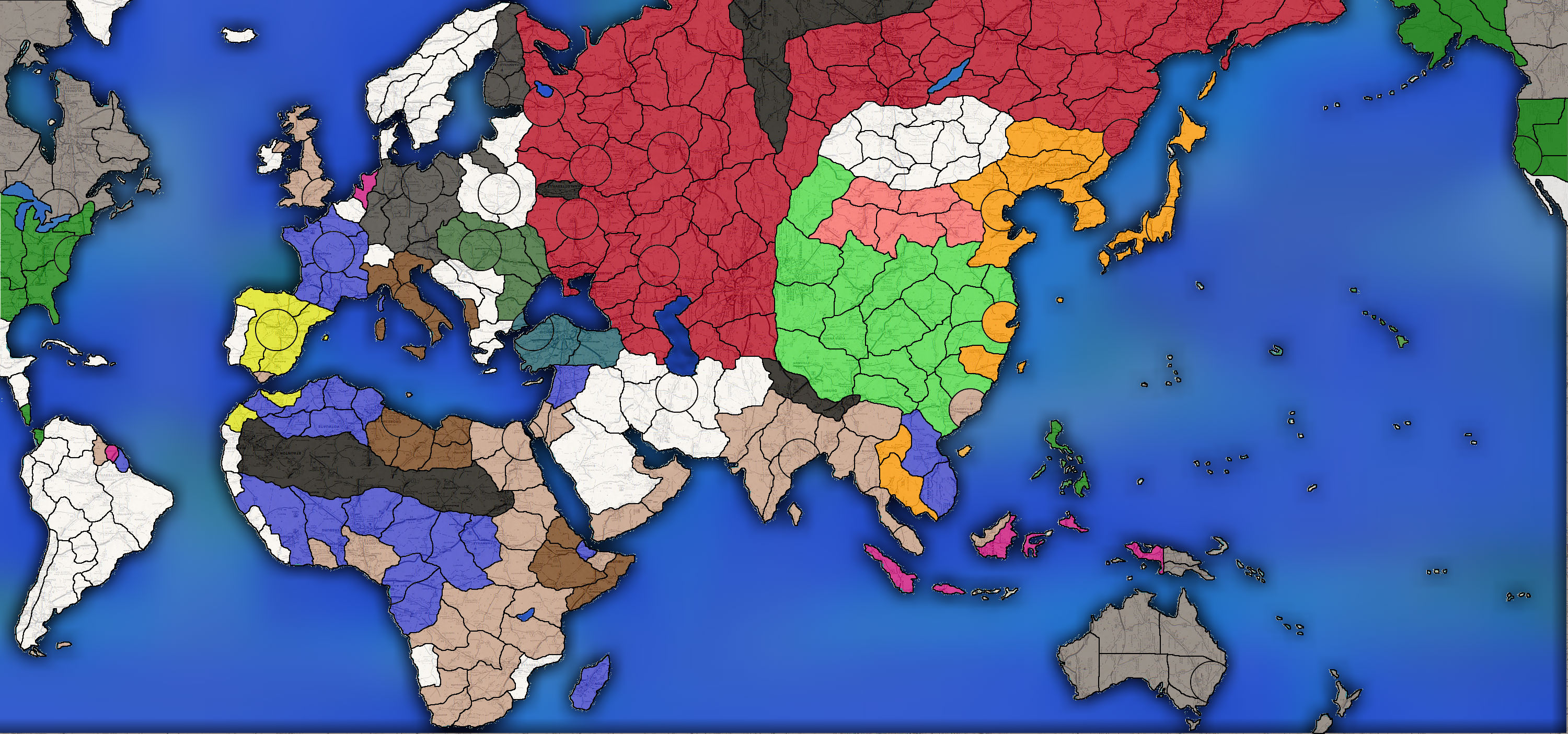
WOW! So many territories in this one. Now it will take 8 turns to get from Berlin to Moscow. Still, I like how some of the big countries are broken up, like the US. You even made Alaska and Brazil 3 territories each.
A couple of questions:
1 Why does France get part of British Somaliland?
2 The city circle in the Middle East just below the Caspian Sea; is that Tehran or Baghdad?
3 Why is Mexico white neutral and not green US territory? -
1. There was also a french somaliland
2. The city is Tehran
3. Because mexico isn’t part of the USA -
What’s going on with Belgian Congo?
Not sure I like East Prussia bordering Warsaw, Polish borders look off.
-
The congo will be divided into 3 spaces, otherwise it will be the largest space on the board.
Prussia touches warsaw only so Germany can knock Poland out of the war in one turn
-
Good map, a few bad things:
Rio de Oro is French? Put a base at Dakar (FWA)
Where is Belgium?
Rome is too far north, Anzio is a tt?
That same fake Russian roundel instead of the Red Star.
Brazil falsely allied to the USA.
Calcutta capital of India instead of Delhi.
Gibraltar and Hong Kong as tts; I much prefer them as UK ports in Spanish/Chinese tt.
-
Yes, but why is it British?
The congo will be divided into 3 spaces, otherwise it will be the largest space on the board.
-
The current colors are just a rough outline. After I put down sea zones I’ll pull out a microscope and make sure all the territories belong to their rightful owner.
-
I don’t need no stinkin’ microscopes.
-
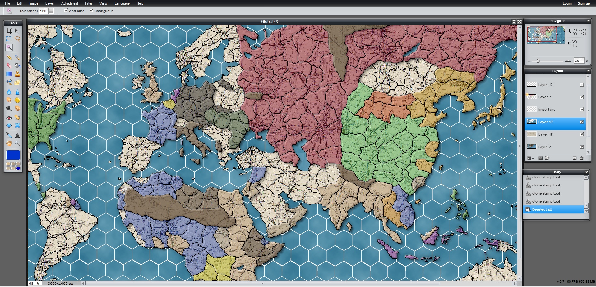
Here is a preview of where the project is headed.
I am toying with the idea of hexagonal sea zones.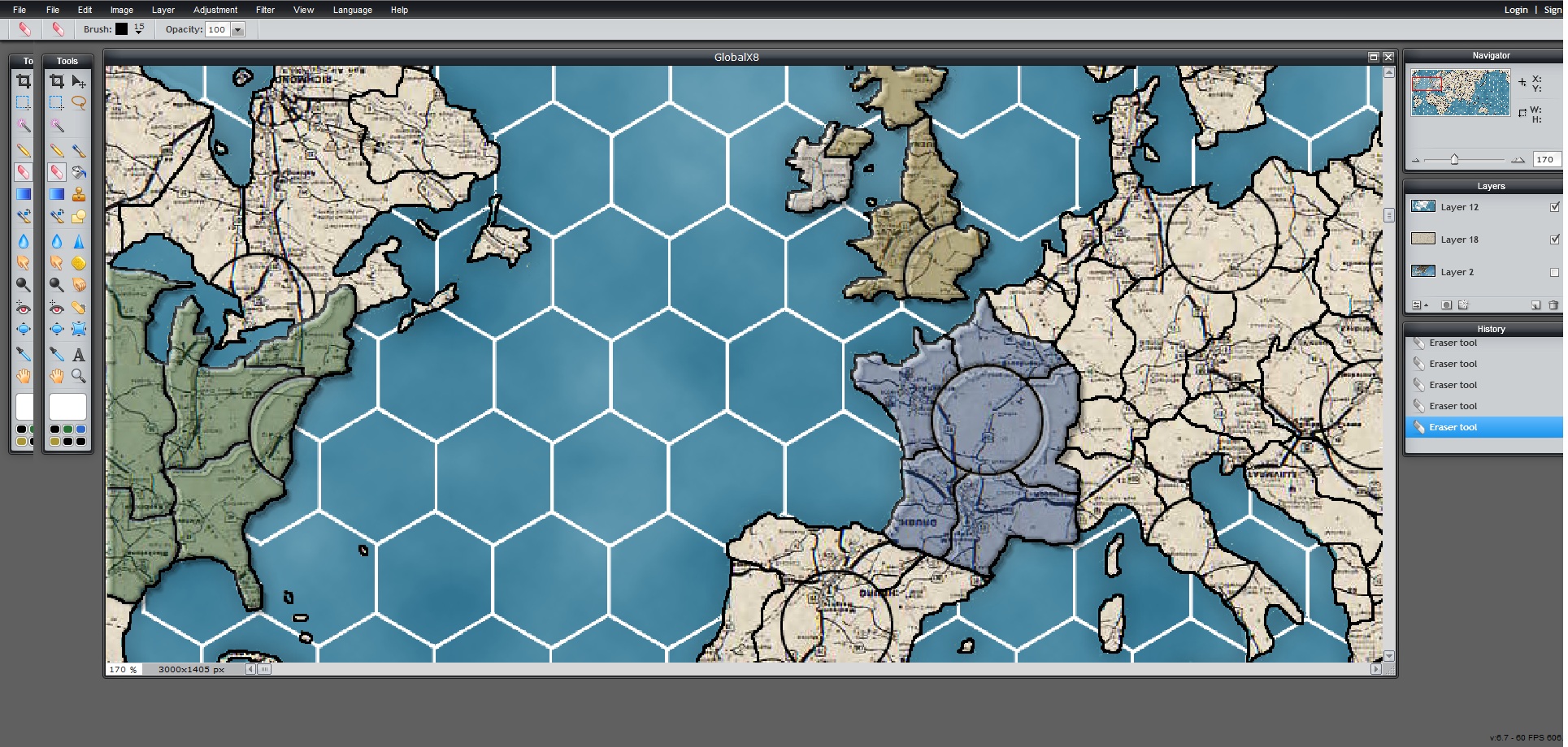
-
Interesting with the smaller sea zones. It looks like 5 spaces from E USA to England and Europe. So, if the US wants to move troops over, they will have to spend at least one turn at sea with the troops on the transports and vulnerable to U-boat attacks.
-
Thats the whole point of this project, so US forces can’t just get shucked to France every turn and bombard every turn like clockwork.
In this game, you would need to build up a big force in England.
The IPC values will probably be 2x their 1940 levels so the US will probably be making 150 when at war and 75 when at peace
My ruleset will probably have CONTESTED territory also, but combats will last D6 rounds, not just one. Naval combat will also last D6 rounds (each battle rolls individually)
Ports won’t have mines, but will extend AA coverage into the sea zone if you also have AA guns
-
Here is some more progress, still a long way to go. Some sea zones need touched up so they merge with territories
-
Not a real fan of the hexagons, they make things harder to assume what is adjacent to what. The shade of the land masses makes it harder/more painful to see the borders between territories.
-
A buddy of mine convinced me on the hexagons to limit destroyer blocking and because the oceans are a featureless void.
Im looking for solutions to the color issue but remember the map will be blown up to 8 ft and have names and rounels when done.
-
I also don’t like the hexagons, especially with normal territories it doesn’t look right in my opinion. But I do get the “non” blocking of DD’s however. But I wouldn’t do it…
Further I would still suggest to change the Belgium, France and German borders.
-
Love the hex idea for the sea zones, I had the same idea a few years back when i was making a WW1 map for my own personal use. You need to make the territory outlines larger/bolder, or change the colour to distinguish better between the roads in the background.
Suggested Topics

