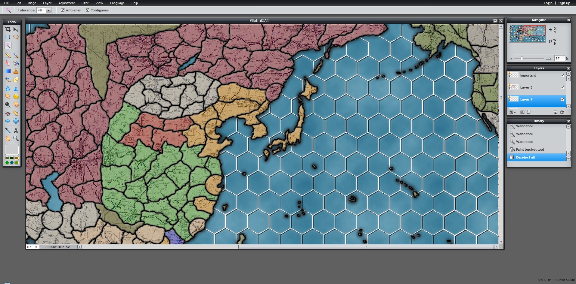
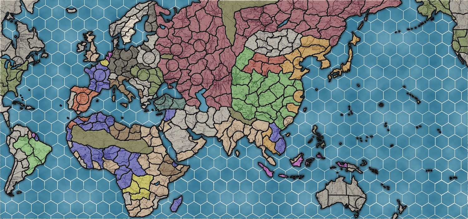
• Customizer

    Interesting with the smaller sea zones. It looks like 5 spaces from E USA to England and Europe. So, if the US wants to move troops over, they will have to spend at least one turn at sea with the troops on the transports and vulnerable to U-boat attacks.


  • Thats the whole point of this project, so US forces can’t just get shucked to France every turn and bombard every turn like clockwork.

    In this game, you would need to build up a big force in England.

    The IPC values will probably be 2x their 1940 levels so the US will probably be making 150 when at war and 75 when at peace

    My ruleset will probably have CONTESTED territory also, but combats will last D6 rounds, not just one. Naval combat will also last D6 rounds (each battle rolls individually)

    Ports won’t have mines, but will extend AA coverage into the sea zone if you also have AA guns


  • Here is some more progress, still a long way to go. Some sea zones need touched up so they merge with territories

    temp2.jpg


  • Not a real fan of the hexagons, they make things harder to assume what is adjacent to what.  The shade of the land masses makes it harder/more painful to see the borders between territories.


  • A buddy of mine convinced me on the hexagons to limit destroyer blocking and because the oceans are a featureless void.

    Im looking for solutions to the color issue but remember the map will be blown up to 8 ft and have names and rounels when done.


  • I also don’t like the hexagons, especially with normal territories it doesn’t look right in my opinion. But I do get the “non” blocking of DD’s however. But I wouldn’t do it…

    Further I would still suggest to change the Belgium, France and German borders.


  • Love the hex idea for the sea zones, I had the same idea a few years back when i was making a WW1 map for my own personal use. You need to make the territory outlines larger/bolder, or change the colour to distinguish better between the roads in the background.


  • The territory borders will be more defined.


  • Ive got the territory borders more defined, but ive got a lot of pixelation around the coasts when I blow it up to 8 ft by 4 ft.
    I may have to start from the ground up with my original trace…which would be quite annoying, but perhaps necessary.

    temp3.jpg

  • Customizer

    I noticed Okinawa is right on the border between two sea hexes. Since Okinawa is a small island, you might consider moving it just a bit so it is fully in one sea hex.


  • Yea, thats the next step in this never ending process.


  • Hey Oztea,

    hows the map coming along?

    I have a suggestion for the sea zones if you are staying with the hexes. I believe you should keep ocean zones as hexes, but sea zones and coastal waters should have drawn out zones like in the official games. This creates a clear image of which zones naval and air bases control over.

    An example would be making the sea of japan one sea zone. Split up the Mediterranean, Baltic, Black, Red, etc. seas into non hex zones. Islands are fine in hexes because they are small and able to fit into small zones. But i think continental territories should not have to defend multiple sea zones.

    If you create large sea zones around coastal waters this shows the zone of control naval and air bases will have. This will also prevent you from having to split up your navy to prevent an amphibious assault.

    Another way to do it without adjusting the map is to create a rule where if your navy is sitting in a naval base. They have control over all adjacent sea zone hexes. OR Battle of the Bulge style. Your ships have a zone of control over adjacent hexes no matter where they are on the map. So if an enemy navy enters an adjacent hex to your navy. The defender can decide to intercept or the attacker can decide to do battle.

    To be honest I prefer my first suggestion with the coastal territories being larger. There is no complex rules and less confusing to which sea zone connects to which land territory.

    Also these are just suggestions. It is your map you don’t have to listen to me lol  :wink:

  • Customizer

    I disagree.  I like the smaller sea zones, including around Japan, Great Britain, etc. I think it makes more sense. For example, on the 1940 map, they have 1 sea zone for the US Atlantic coast. It stretches from Maine all the way to Texas. That’s too far. Even if you want to cover the entire east coast, I still think there should be another sea zone for the Gulf of Mexico, with a line going from southern Florida to Cuba, or something similar.
    With oztea’s map, the east coast of the US is broken up by several sea zone hexes which I think is much more realistic. After all, you could possibly invade Florida without being affected by stuff up in New York or over in Texas.


  • This project has completely stalled.

    The issue of grouping hexes togehter close to shore lines wouldn’t work because you could make very odd movements. Because ships can move 2 spaces, you could jump into a coastal sea zone from a small hex, then move out of that coastal zone to any other hex it touches, like leap frogging over 5 other hexes.

    Unless coastal hexes stopped movement instantly….


  • This map looks badass.  You could see some success if you finished it, I think.

    Do you think octagons would work instead of hexagons?  I have next to no idea how to go about creating a map like this, but I figure suggesting doesn’t hurt.  I haven’t thought out how octagons would work.

    I’m also wondering what your rules are going to be; similar to GW39, or G40, or something entirely designed by you?  Tigerman’s rules don’t seem too bad lol, those are what I like to use, for the most part.

  • Customizer

    @oztea:

    This project has completely stalled.

    The issue of grouping hexes togehter close to shore lines wouldn’t work because you could make very odd movements. Because ships can move 2 spaces, you could jump into a coastal sea zone from a small hex, then move out of that coastal zone to any other hex it touches, like leap frogging over 5 other hexes.

    Unless coastal hexes stopped movement instantly….

    I thought your map was coming along very well. I really like your idea of the hex sea zones. Maybe I’m just not seeing it, but I don’t get how you could “skip” over several hexes from one of the coastal hexes. Did you eliminate the hex pattern when you got to coastal areas? If so, I think that was a mistake. You should keep the hex pattern for ALL the sea zones right up to any coast. In some cases, you will have to make minor adjustments, like if you want a sea zone border to line up with a land border, or to scoot some islands a bit so they are not straddling two sea zones, but overall the effect will be brilliant. For one thing, there will be a lot more sea zones up against the larger land areas. For example: Take the US Atlantic coast. That’s a lot of area and shouldn’t be just 1 sea zone. With your hexes, you will create several sea zones all along the coast which I think makes things more realistic. After all, if the Axis invaded, it would be in a more localized area don’t you think? It wouldn’t be an invasion stretching from Miami to Maine.

    Stick with the hex sea zones. You had a great idea there.


  • After reading both of your comments, Knp and Oztea. I concede that my idea of larger coastal territories was a bad idea. I actually like the hexes up to the coast better. My only concern was trying to defend a land zone from amphibious assault without having to split up my navies. Also when i came up with the idea i didnt envision a sea zone stretching from maine to texas. More like 3 sea zones along that coast. Which is pretty close to what the hexes are already doing on the american east coast. My idea was geared more towards waters such as the Mediterranean seas, Baltic, and the sea of Japan.


  • I own the first edition 1939 map by tigerman, and have played it a lot of times with my wife.  I liked your map that shows the proportions of both maps back on the first or second page

    I haven’t been able to find one like that of the 1939 changes between first and second edition and ultimately what you did with the land masses is so much what me and my wife noticed and critiqued on our very first play through on 1939…  too much emphasis on areas that just don’t need emphasis.  Although we play with our own special house rules and see fights through africa and the turkey / saudi arabia / Iran area’s quite more often because of it so having those areas works well for us.

    Looking at how you did the hexes I find it confusing on some of your island chains, you most likely will have to customize positions of islands a bit out of geographically correct positions in order for them to ‘flow’ with the hexes, but I really like  the idea of the hexes as it makes the sea zone battles a lot more tactical then strategical as with the bigger zones in 1939.  As much as I liked 1939 we drew extra sea zones on the map on our 3rd game because we found it too easy to get to specific spots to quickly (including Atlantic crossing, we made it where it takes 2 turns to get across from ANY point as well with a black sharpie)

    I personally really dislike the road art on the map,  I would have to seriously think twice about buying it if it is as prevalent as it is in these pictures.  Its ‘TOO’ distracting from the borders, even with them being enlarged/darkened…  I have no real preference on solid color over realistic over some background noise as the background of the map, but I just find the straight lines of the roads and such to prevalent and distracting.  Hopefully you make them less visible but still noticeable.  Your choice thou.

    The 1939 first edition was annoying with sea ports and airports displayed on the map, but with the lack of space in most places for units it worked well…

    Might I ask ‘has completely stalled’ is that still in effect?


  • It is still completely stalled. I was using a free program called Pixlr, which is a photoshop clone, but it has its limitations. One such limitations is size.  (http://pixlr.com/)

    I would have to completely start from scratch, and do Europe and Pacific as separate maps. Or at least, separate files then merge them.

    As to the hexes, lets use this fictional area as an example of the problem I am getting at:

    Lets take first SZ 12a and 12b. The hexes fall in a bay, and merging them seems appropriate, no major problem here that I can think of now.

    But lets look at SZ 4a and 4b, because here is my main problem.

    Imagine a soviet fleet in SZ 2. It can move through SZ 4 (merged 4a and 4b) and get to SZ 8. Even though moving through SZ 5 it could only get to SZ 9.

    It gets even more problematic when lets say a german fleet in SZ 20 has a port to use. And moves into SZ 13 (merged 13a and 13b) into SZ 8, then into SZ 4.

    Because some of the coast hexes have to merge, you can hug the coast and cut off a whole bunch of time.

    Conventional movement from SZ 20, to 21, to 17 to 14, to 9, to 5, is much longer.

    Hence a major roadblock. I would have to design the land to fit the hexes. So an entire redesign was needed.

    hexes.png


  • Before I totally gave up, this is as far as I got.
    There was a lot of noise around the borders, because I am a photoshop amateur.
    And to put text on it, I had to blow it up to full size, unvectored, and it got really blurry.

    I couldn’t figure out how to put a font on, or IPC markings….I got frustrated.

    Though typing this out is getting me in the mood to try again…

    GlobalXA22.jpg

Suggested Topics

Axis & Allies Boardgaming Custom Painted Miniatures

55

Online

17.0k

Users

39.3k

Topics

1.7m

Posts