

Awesome ! One of my Favorite parts of G 40 Expansion :)
IL's Axis and Allies Global 1939 and 1942 files
-
@Imperious:
And i wish people just tried the game, then shooting down it because it does not allow candyland.
Im sorry, i shouldnt have said that. I dont mean to shoot your game down, I only got so much cash though.
-
LOL…
This topic seems like a good old western movie.
IL = the good
crusader IV = the bad
Emperor taiki = and the ugly. -
as long as i dont die at that end.
-
I’ve played more candyland games more then any other board game (other then monopoly)
-
Well my map can be printed from any printer on 8.5 x 11 sheets and taped together. That cant cost more than $20 in ink
-
as long as i dont die at that end. :-D
Oh, and I forgot, I bought a book recently….Fateful Choice by Ian Kershaw.
We understand better the fundamental differences between the Imperial navy and the army.
The choice to attack USA instead of the USSR was not so easily made as we think of it. -
I’ll try the 8.5x11 thing, and those sound like some pretty intersting books crusaderiv.
-
IL will you ever do a global size game using your new rules. You could base it on the new G40 map but just add a neew set up and rules. I would love to see a G39. Will you be making any thing like that. :? :?
-
Not clear at this time.
But the AAE40 map might be reconfigured into a 1939 map depending on the final product. The of weight of this decision will be based on how accurate the OOB map is.
-
IL can you give me a list of parts and stuff I will need to play this. I will have G40 games and AA42. I am mostly confused on the new pieces colours.
-
These items are listed on the first page.
You really only need 1 each AAE40 and AAP40 and some units for fortifications ( table tactics infantry with gun cut off)
-
bumper
-
Early draught of my take on the Global map.
Includes list of neutral alignments on vital dates.
-
The names are based on 1939-1941 actual maps in 99% of the cases. These are cross confirmed with various other maps produced in USA and UK in this period.
-
Maps often lag behind official name changes, while names such as “Volgagrad” and “Belarus” by definition did not exist until long after the war.
Of course there’s nothing wrong with using names such as “Mesopotamia”, but the government of the country at the time called it “Iraq” so that’s what I prefer to go along with.
-
Maps often lag behind official name changes, while names such as “Volgograd” and “Belarus” by definition did not exist until long after the war.
Of course there’s nothing wrong with using names such as “Mesopotamia”, but the government of the country at the time called it “Iraq” so that’s what I prefer to go along with.
But these are the maps that were created from various sources of the day. My maps always use the vernacular of the time they are representing.
If the Generals who planned their battles made maps that used these titles, those are the ones i want to use and in view of any information to the contrary the names i used are more official in terms of this outlook.
I don’t go by maps printed after the war ended, when various nations tried to throw off the names that were established by the colonial powers. They have no credibility to a map thats said to contain the information that war planners would have used in these times.
And i don’t have Belarus on my map. I have no idea why you made that comment since it does not apply in this case.
-
@Imperious:
Well my map can be printed from any printer on 8.5 x 11 sheets and taped together. That cant cost more than $20 in ink
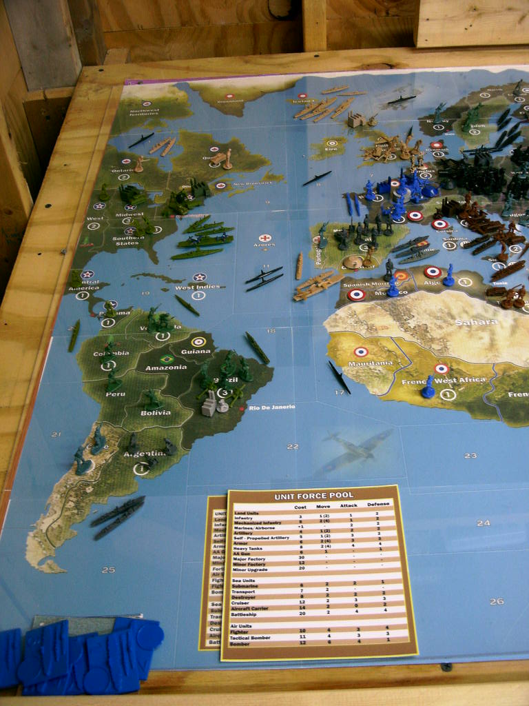
ILs 1939 setup.
-
@Imperious:
Well my map can be printed from any printer on 8.5 x 11 sheets and taped together. That cant cost more than $20 in ink
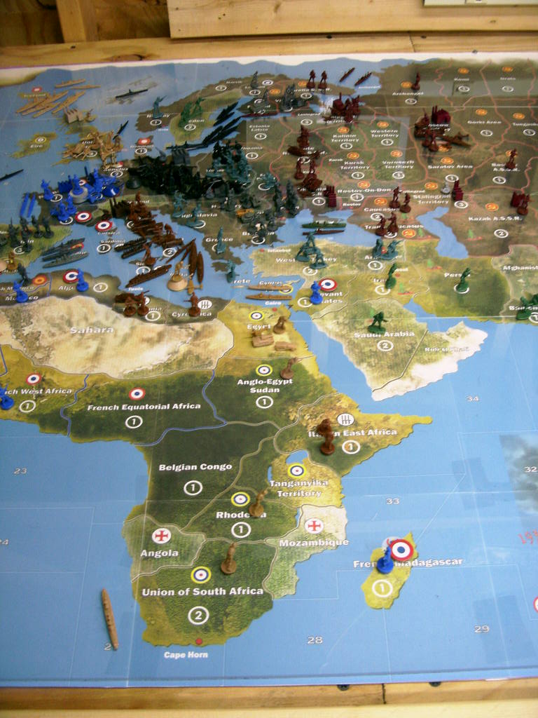
ILs 1939 setup.
-
@Imperious:
Well my map can be printed from any printer on 8.5 x 11 sheets and taped together. That cant cost more than $20 in ink
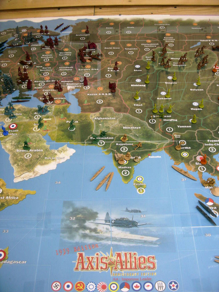
ILs 1939 setup.
-
@Imperious:
Well my map can be printed from any printer on 8.5 x 11 sheets and taped together. That cant cost more than $20 in ink
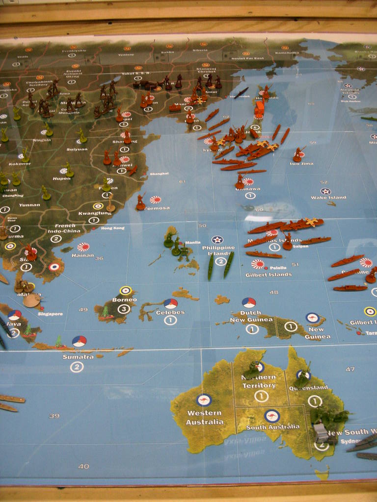
ILs 1939 setup.
Suggested Topics

