

@black_elk Rock On !!!.png
Oztea tries to make a map
-
I think your map looks great. So some of the territories are a little misshapen, sometimes you have to do that for better game play. I also like the circles for the big cities and think it’s pretty cool that you made some that we don’t normally have on current A&A games, like Helsinki, Finland. I guess if you wanted to treat Finland like an Axis Minor, they should have their own capital that the Allies could possibly capture.
I think I have identified most of the cities, but not sure about a few of them:
The circle just south of Warsaw, is that Budapest, Hungary?
The circle in the middle of North Africa, is that Tripoli, Libya?
There are two new circles in Russia, just west of Moscow. The one just below the Pripet Marshes is Kiev, right? What is the one just above the Pripet Marshes?
The circle in Northern China along the coast, is that Beijing? I’m pretty sure the southern one is Shanghai.I know you can’t make a circle around them, but I assume that Manila and Honolulu would also be included. I guess in those cases, the whole island(s) would be considered their territory.
I think you are doing a great job. I’m sure it is taking a lot of work. Hope you are able to finish it because I would like to see the finished product. Are you going to print air bases and naval bases on it?
-
Very observant Knp, but no printed air bases or naval bases.
Smolensk is the other Russian city south of Leningrad.If it’s similar to global 39 thats fine with me. I own an 8x4 of that but there are some major flaws on it in my opinion. Scale, color and sea zones are all flawed in some way or another in my opinion.
Oztea, please explain what you think the flaws are in the map? I can understand color! But, scale and sea zones? Sea zones can easily be worked around if you take away NB advantage of 3 moves. Make combat move 2 moves and NCM 4.
-
I think I have identified most of the cities, but not sure about a few of them
The circle which (I assume) is intended to represent the capital of Canada seems to be centered on Toronto rather than Ottawa.
-
I like the increased articulation of the map.
Regarding Shanghai, that territory can incorporate Nanjing since they’re so close. Toronto and Ottawa are relatively close enough that the placement on the map is fine.
I like the division of the US, though having DC as its own territory creates the unique circumstance of having a capital with minimal manufacturing capability. Though on second thought it includes Philly and Baltimore so it should have a respectable IPC value (New York/New England and Midwest will be the heavy hitters I imagine).
I love the addition of the Chinese commies.
And if Spain, Finland, Greece and Romania/Bulgaria/Hungary will be minor powers, why not Canada?
-
Finland should have an Arctic coastline, that is before the Winter War.
-
Canada would be its own power, or merged with ANZAC as the UK Common Wealth (so grey units )
Finland will probably get an arctic coastline in the final version.As for what I find are shortcomings of the global 39 map….
The ports and airbases printed on the map itself are kind of distracting.
Obviously the convoy box system is outdated, and the raiding spaces in 1940 work much better in my opinion. The convoy boxes should be done away with.
(except perhaps a special battle of the atlantic zone, however just placing CONVOY symbols with a ghosted US/UK/Canadian Roundel beneath would denote that the general treasury is raided from these north Atlantic sea zones.
Rio De Oro is French (but should be Spanish) and gives the allies a port on mainland Africa
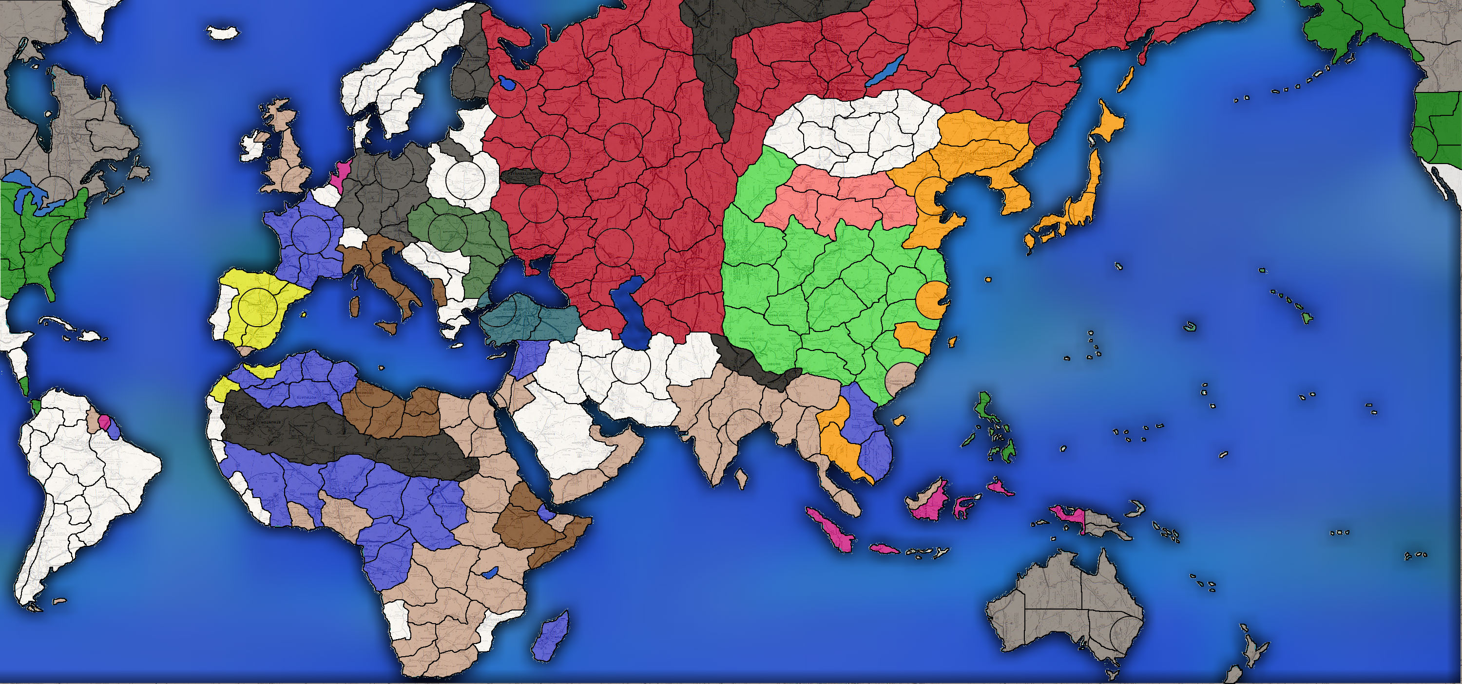
Even if the combat move for ships is reduced to 2, US forces can stage in Quebec, and move directly to SZ 28 and land in NormandyFor a scale comparison,see the attached image.
North America, South America and Africa are all much bigger than they need to be, as is mainland Asia.Don’t get me wrong though, the map is good, I mean, hell…I bought one. But these few nagging issues have kept me from enjoying it to the fullest.
The 1940 map has a really good scale to it I feel. Has much more room for ships in the pacific, and much more room on Europe for land combat.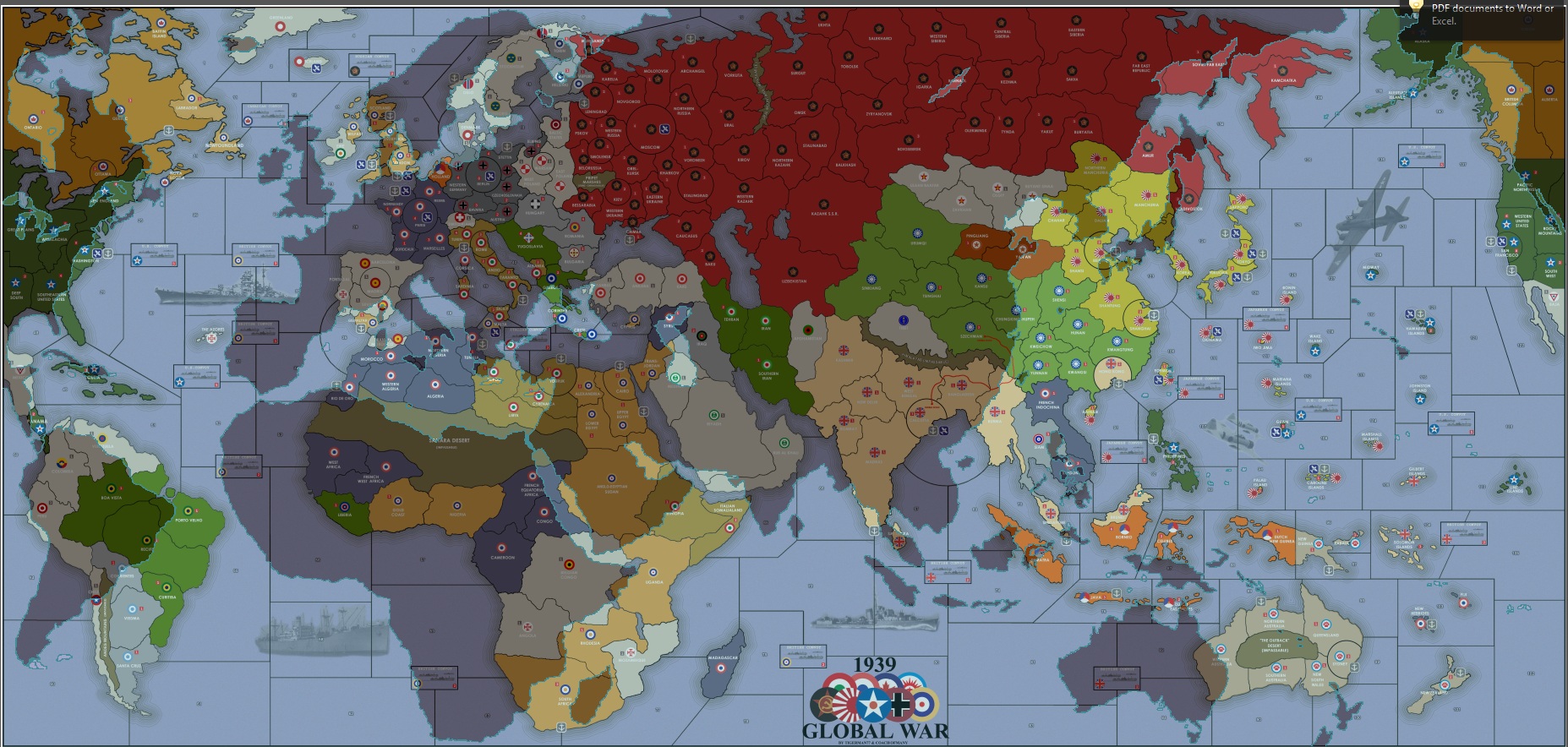
-
Canada would be its own power, or merged with ANZAC as the UK Common Wealth (so grey units )
Finland will probably get an arctic coastline in the final version.As for what I find are shortcomings of the global 39 map….
The ports and airbases printed on the map itself are kind of distracting.
Obviously the convoy box system is outdated, and the raiding spaces in 1940 work much better in my opinion. The convoy boxes should be done away with.
(except perhaps a special battle of the atlantic zone, however just placing CONVOY symbols with a ghosted US/UK/Canadian Roundel beneath would denote that the general treasury is raided from these north Atlantic sea zones.
Rio De Oro is French (but should be Spanish) and gives the allies a port on mainland Africa
Even if the combat move for ships is reduced to 2, US forces can stage in Quebec, and move directly to SZ 28 and land in NormandyFor a scale comparison,see the attached image.
North America, South America and Africa are all much bigger than they need to be, as is mainland Asia.Don’t get me wrong though, the map is good, I mean, hell…I bought one. But these few nagging issues have kept me from enjoying it to the fullest.
The 1940 map has a really good scale to it I feel. Has much more room for ships in the pacific, and much more room on Europe for land combat.We have revised the 39 map and made Europe much larger as well as Africa along with the med, western Russian and even Britain. We also took away all of the NB and AB. Check it out on HBG website. I will admit the first 39 map needed some changes.
As far as the US staging in Canada. What would be the difference in them staging there or in the UK? It would still be 2 turns to get a unit from the US to France. -
Its improved slightly, but it still has a long way to go in my opinion.
The convoy boxes are still a holdover from editions long past.
The colors are simple, but effective, but….boring. And the new “mountain range” texture looks out of place. As does the ghosted names over Russia, Germany, etc.It certainly isn’t bad, it just isn’t precisely what I’m looking for.
And if I am going to have something on an 8x4 table in my basement it had better be 99% up to my standards.I really am looking for a game where loaded US transports are vulnerable in the north atlantic. (that many sea zones) so you actually have to fear German subs. Instead of just unloading at london, so the land units are safe.
-
Curious, why does Mongolia have 11 territories? Seems a little over the top for a country that was really a nothing in terms of its strength or influence at the time.
Is this just to mimic terrain issues and slow progress of either side through that area?
-
So Japan can’t sneak through there in an attempt to get to Moscow. 90% of those territories will be worthless and only exist to keep Japan honest.
-
If you plan to make the north Atlantic larger, you should add the Azores. The allies used those islands to stage their navy and aircraft to protect the convoys and hunt U-boats.
-
I don’t want a space in the atlantic where the allies can unload transports while en route to europe. (so that if said fleet is attacked, the land units are safe on dry land)
I want the US to have to protect loaded transports as they cross the atlantic, but for it to take 2 turns at least.
Here is a pic of the temporary progress. Without seazones of course.
-
cool map so far, nice work oz!
-
LMFAO!!
For whatever reason everybody uses that background ghosted image from one of my maps. Triple A, and now this. It was originally a picture from part of Russia
-
Not “from your map”, just in the style of it.
Found the image on google image search and tiled it.Its not a “part of Russia” because it has places like “Richmond” and “Colonial Heights” labeled on it. Which you can see clearly, upside down, in northern Quebec.
The road map texture is a preferable alternative to the “terrain texture” of the 1940s map, and the “solid colors” of the 1939 Global map.I might tone back the opacity of the colors from 75 to 50, or lower, in the final version, because once I have roundels on the map the colors wont be as necessary.
-
WOW! So many territories in this one. Now it will take 8 turns to get from Berlin to Moscow. Still, I like how some of the big countries are broken up, like the US. You even made Alaska and Brazil 3 territories each.
A couple of questions:
1 Why does France get part of British Somaliland?
2 The city circle in the Middle East just below the Caspian Sea; is that Tehran or Baghdad?
3 Why is Mexico white neutral and not green US territory? -
1. There was also a french somaliland
2. The city is Tehran
3. Because mexico isn’t part of the USA -
What’s going on with Belgian Congo?
Not sure I like East Prussia bordering Warsaw, Polish borders look off.
-
The congo will be divided into 3 spaces, otherwise it will be the largest space on the board.
Prussia touches warsaw only so Germany can knock Poland out of the war in one turn
Suggested Topics

